

#4 100K Nizamabad Durki Round-trip via Varni
A cycling route starting in Nizāmābād, Telangana, India.
Overview
About this route
- 6 h 57 min
- Duration
- 103.6 km
- Distance
- 786 m
- Ascent
- 757 m
- Descent
- 14.9 km/h
- Avg. speed
- ---
- Max. altitude

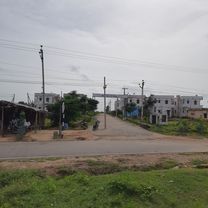
Route photos


Route quality
Waytypes & surfaces along the route
Waytypes
Cycleway
29 km
(28 %)
Quiet road
15.5 km
(15 %)
Continue with Bikemap
Use, edit, or download this cycling route
You would like to ride #4 100K Nizamabad Durki Round-trip via Varni or customize it for your own trip? Here is what you can do with this Bikemap route:
Free features
- Save this route as favorite or in collections
- Copy & plan your own version of this route
- Split it into stages to create a multi-day tour
- Sync your route with Garmin or Wahoo
Premium features
Free trial for 3 days, or one-time payment. More about Bikemap Premium.
- Navigate this route on iOS & Android
- Export a GPX / KML file of this route
- Create your custom printout (try it for free)
- Download this route for offline navigation
Discover more Premium features.
Get Bikemap PremiumFrom our community
Other popular routes starting in Nizāmābād
 Nizamabad Tekriyal
- Distance
- 99.5 km
- Ascent
- 530 m
- Descent
- 530 m
- Location
- Nizāmābād, Telangana, India
 Nizamabad Arepally
- Distance
- 224.6 km
- Ascent
- 929 m
- Descent
- 1,046 m
- Location
- Nizāmābād, Telangana, India
 #4 100K Nizamabad Durki Round-trip via Varni
- Distance
- 103.6 km
- Ascent
- 786 m
- Descent
- 757 m
- Location
- Nizāmābād, Telangana, India
 Nizamabad Keshapur Indalwai Chandrayampally Dichpally NZB By pass home
- Distance
- 61.9 km
- Ascent
- 667 m
- Descent
- 677 m
- Location
- Nizāmābād, Telangana, India
 NZB - Bypass - Dharmaram - Mentrajpally - NH44 - Nirmal
- Distance
- 74.8 km
- Ascent
- 569 m
- Descent
- 479 m
- Location
- Nizāmābād, Telangana, India
 Nizamabad and Gandhari through Kamareddy hill ranges
- Distance
- 107.5 km
- Ascent
- 1,007 m
- Descent
- 1,062 m
- Location
- Nizāmābād, Telangana, India
 #9 100K Nizamabad Ramareddy
- Distance
- 115.7 km
- Ascent
- 1,068 m
- Descent
- 1,038 m
- Location
- Nizāmābād, Telangana, India
 Nizamabad to Nandipet
- Distance
- 23.6 km
- Ascent
- 97 m
- Descent
- 122 m
- Location
- Nizāmābād, Telangana, India
Open it in the app