

Schloßbichl - Nöring - Landfraß - Treffling - Seeboden - Altersberg
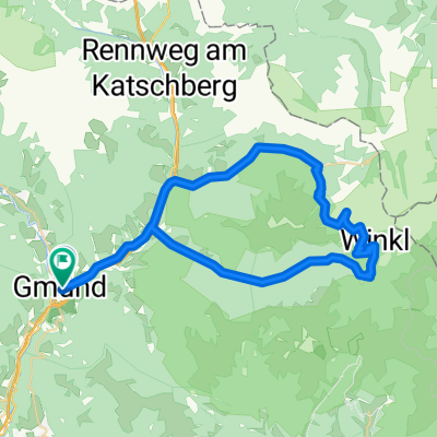
A cycling route starting in Gmünd, Carinthia, Austria.
Overview
About this route
Very varied and beautiful route. Heavily trafficked main roads are used only briefly, otherwise there are many singletracks, forest paths and country roads. Kreuschlach: Short climb on a singletrack up to the castle, then a medium-length climb up to Kreuschlach. The descent from Kreuschlach to the main road is quite steep and difficult. Not suitable for beginners!! Nöring: Short section of main road to Eisentratten, then a little-used paved road to Innernöring. The following climb is quite steep and long. Landfraß: Long forest section followed by a long descent on a very well-built gravel road to Oberbuch. Then a climb up to Perau. From Perau, a very beautiful Nockbike route below the Trefflinger country road. After crossing the stream, a short but very steep climb on a singletrack. Treffling: Back on the country road, descent to Trasischk and then with a headwind ;) to Treffling. Long, fairly fast descent to Seeboden, usually with a lot of traffic. Lieserhofen: On the busy main road from Seeboden to Lieserhofen. Steep passage through the residential area to Lieserhofer Straße. Then a very steep section with a following descent to the bridge. Trebesing: Steep climb up to the access road to Altersberg, then a more relaxed part to Trebesing. Finally, quite mellow section with short climbs through Trebesing and back by bike to Gmünd and Schloßbichl.
- -:--
- Duration
- 41.8 km
- Distance
- 897 m
- Ascent
- 897 m
- Descent
- ---
- Avg. speed
- ---
- Max. altitude

Continue with Bikemap
Use, edit, or download this cycling route
You would like to ride Schloßbichl - Nöring - Landfraß - Treffling - Seeboden - Altersberg or customize it for your own trip? Here is what you can do with this Bikemap route:
Free features
- Save this route as favorite or in collections
- Copy & plan your own version of this route
- Sync your route with Garmin or Wahoo
Premium features
Free trial for 3 days, or one-time payment. More about Bikemap Premium.
- Navigate this route on iOS & Android
- Export a GPX / KML file of this route
- Create your custom printout (try it for free)
- Download this route for offline navigation
Discover more Premium features.
Get Bikemap PremiumFrom our community
Other popular routes starting in Gmünd
 Leoben i.K. - Treffling - Millstatt - Altersberg - Leoben i.K.
- Distance
- 50.2 km
- Ascent
- 677 m
- Descent
- 677 m
- Location
- Gmünd, Carinthia, Austria
 Treffenboden 27 nach Blutige Alm
- Distance
- 58.3 km
- Ascent
- 1,430 m
- Descent
- 1,601 m
- Location
- Gmünd, Carinthia, Austria
 Maltaberg
- Distance
- 15.2 km
- Ascent
- 808 m
- Descent
- 808 m
- Location
- Gmünd, Carinthia, Austria
 Malta Hochalmstrasse
- Distance
- 47.4 km
- Ascent
- 1,165 m
- Descent
- 1,163 m
- Location
- Gmünd, Carinthia, Austria
 Nockalm runde
- Distance
- 55 km
- Ascent
- 1,275 m
- Descent
- 1,280 m
- Location
- Gmünd, Carinthia, Austria
 MI9 Gmünd - Gemünder Hütte 21+21 350HM
- Distance
- 21.7 km
- Ascent
- 496 m
- Descent
- 39 m
- Location
- Gmünd, Carinthia, Austria
 Nockalmrunde
- Distance
- 55.3 km
- Ascent
- 1,479 m
- Descent
- 1,478 m
- Location
- Gmünd, Carinthia, Austria
 Gries an der Lieser 76, Gmünd in Kärnten nach Gries an der Lieser 76, Gmünd in Kärnten
- Distance
- 14.3 km
- Ascent
- 512 m
- Descent
- 565 m
- Location
- Gmünd, Carinthia, Austria
Open it in the app