

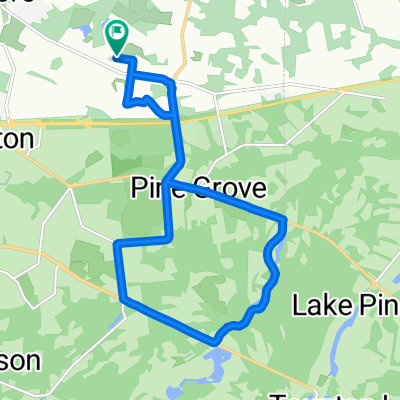
Wentworth Cir, Marlton to 23–47 Highland Park Dr, Toms River
A cycling route starting in Marlton, New Jersey, United States.
Overview
About this route
- 4 h 40 min
- Duration
- 80 km
- Distance
- 102 m
- Ascent
- 118 m
- Descent
- 17.2 km/h
- Avg. speed
- 57 m
- Max. altitude
Route quality
Waytypes & surfaces along the route
Waytypes
Quiet road
44 km
(55 %)
Road
19.2 km
(24 %)
Surfaces
Paved
20.8 km
(26 %)
Asphalt
20.8 km
(26 %)
Undefined
59.2 km
(74 %)
Continue with Bikemap
Use, edit, or download this cycling route
You would like to ride Wentworth Cir, Marlton to 23–47 Highland Park Dr, Toms River or customize it for your own trip? Here is what you can do with this Bikemap route:
Free features
- Save this route as favorite or in collections
- Copy & plan your own version of this route
- Sync your route with Garmin or Wahoo
Premium features
Free trial for 3 days, or one-time payment. More about Bikemap Premium.
- Navigate this route on iOS & Android
- Export a GPX / KML file of this route
- Create your custom printout (try it for free)
- Download this route for offline navigation
Discover more Premium features.
Get Bikemap PremiumFrom our community
Other popular routes starting in Marlton
 Kettle Run Rd, Marlton to Kettle Run Rd, Marlton
- Distance
- 6.6 km
- Ascent
- 182 m
- Descent
- 179 m
- Location
- Marlton, New Jersey, United States
 Tuckerton Road 984, Evesham to Chews Landing Clementon Road 1336, Gloucester Township
- Distance
- 16.4 km
- Ascent
- 44 m
- Descent
- 0 m
- Location
- Marlton, New Jersey, United States
 Country Farms-Baron run loop
- Distance
- 15.5 km
- Ascent
- 59 m
- Descent
- 56 m
- Location
- Marlton, New Jersey, United States
 Cherokke HS route
- Distance
- 9.5 km
- Ascent
- 47 m
- Descent
- 48 m
- Location
- Marlton, New Jersey, United States
 Kettle Run Rd, Marlton to Kettle Run Rd, Marlton
- Distance
- 9.8 km
- Ascent
- 212 m
- Descent
- 222 m
- Location
- Marlton, New Jersey, United States
 18 Lancaster Dr, Marlton to 230 Mount Laurel Rd, Mount Laurel
- Distance
- 8 km
- Ascent
- 34 m
- Descent
- 45 m
- Location
- Marlton, New Jersey, United States
 Moderate route in Cherry Hill
- Distance
- 4.8 km
- Ascent
- 24 m
- Descent
- 24 m
- Location
- Marlton, New Jersey, United States
 Country Farms Road 124, Evesham Township to Country Farms Road 101, Evesham Township
- Distance
- 15.2 km
- Ascent
- 58 m
- Descent
- 60 m
- Location
- Marlton, New Jersey, United States
Open it in the app