

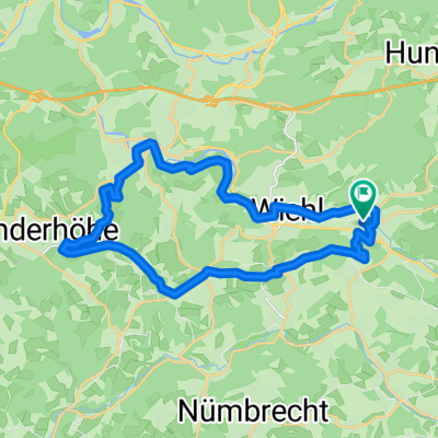
Marienhagener Straße 32, Wiehl nach Kirchweg 10, Wiehl
A cycling route starting in Wiehl, North Rhine-Westphalia, Germany.
Overview
About this route
- 1 h 53 min
- Duration
- 14.5 km
- Distance
- 167 m
- Ascent
- 204 m
- Descent
- 7.7 km/h
- Avg. speed
- ---
- Max. altitude

Route quality
Waytypes & surfaces along the route
Waytypes
Track
6.8 km
(47 %)
Quiet road
4.5 km
(31 %)
Surfaces
Paved
6 km
(41 %)
Unpaved
4.6 km
(32 %)
Asphalt
5.8 km
(40 %)
Gravel
4.5 km
(31 %)
Continue with Bikemap
Use, edit, or download this cycling route
You would like to ride Marienhagener Straße 32, Wiehl nach Kirchweg 10, Wiehl or customize it for your own trip? Here is what you can do with this Bikemap route:
Free features
- Save this route as favorite or in collections
- Copy & plan your own version of this route
- Sync your route with Garmin or Wahoo
Premium features
Free trial for 3 days, or one-time payment. More about Bikemap Premium.
- Navigate this route on iOS & Android
- Export a GPX / KML file of this route
- Create your custom printout (try it for free)
- Download this route for offline navigation
Discover more Premium features.
Get Bikemap PremiumFrom our community
Other popular routes starting in Wiehl
 Überschallgeschwindigkeitsfahrt in Reichshof
- Distance
- 14.5 km
- Ascent
- 456 m
- Descent
- 456 m
- Location
- Wiehl, North Rhine-Westphalia, Germany
 Tour 1 Nick
- Distance
- 17.6 km
- Ascent
- 98 m
- Descent
- 143 m
- Location
- Wiehl, North Rhine-Westphalia, Germany
 Forst
Forst- Distance
- 21.5 km
- Ascent
- 404 m
- Descent
- 380 m
- Location
- Wiehl, North Rhine-Westphalia, Germany
 Ab durch den Wald
- Distance
- 42.9 km
- Ascent
- 913 m
- Descent
- 914 m
- Location
- Wiehl, North Rhine-Westphalia, Germany
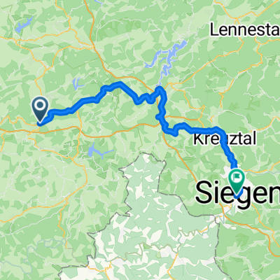 Dieringhausen bis Siegen
- Distance
- 65.3 km
- Ascent
- 824 m
- Descent
- 759 m
- Location
- Wiehl, North Rhine-Westphalia, Germany
 Lengthy ride from Wiehl to Engelskirchen
- Distance
- 46.8 km
- Ascent
- 671 m
- Descent
- 836 m
- Location
- Wiehl, North Rhine-Westphalia, Germany
 Oberwiehl-Ruppichteroth-Oberwiehl
- Distance
- 47.4 km
- Ascent
- 471 m
- Descent
- 449 m
- Location
- Wiehl, North Rhine-Westphalia, Germany
 Feierabend-Ründchen Oberwiehl - Oberwiehl
- Distance
- 23.7 km
- Ascent
- 304 m
- Descent
- 304 m
- Location
- Wiehl, North Rhine-Westphalia, Germany
Open it in the app