

Ariège Est 21
A cycling route starting in Osséja, Occitanie, France.
Overview
About this route
7h Cotxe a Ripoll, 1h 25min
Renfe Ripoll 8:28 - Puigcerdà 9:37h
-
Puigcerdà - Les Cabannes , 130km 2300m+. Complexe des Oustalous (30eur, Albergue)
-
Verdun - Massat, 100kms, 2600m+ (possible pujar amunt bivac a Mur de Peguere)
-
Massat - Prades 170kms, 3200m+
-
Prades - Ripoll, 130kms, 2700m+
PUIGCERDÀ
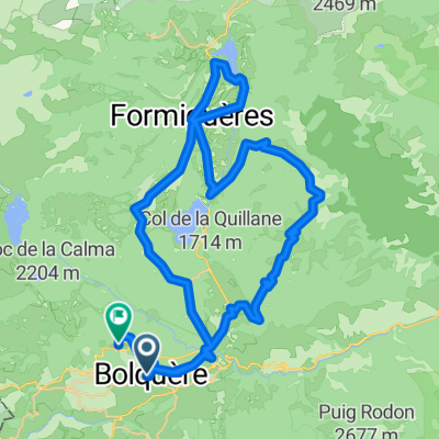
Col de la Quillane 1677m
Col du Pailheres 2011m Chioula - Marmare 1361m LES CABANNES Plateau de Beille 1670m Port de Lers 1517m MASSAT Col Caougnous 947m + Mur de Peguere 1375m Col de Jouels + Col Uscla 1250m Col Calmil Prat D'Albis 1200m (Tour 2019, etapa 15) Col de Jau 1506m PRADES Col Mantet 1760m Roques blanques (Canigo) 2250m Enllaç a Camprodon sense passar per Prats ni Ares: Col Siern 1620m Col Pregon RIPOLL
- -:--
- Duration
- 518.4 km
- Distance
- 8,555 m
- Ascent
- 9,036 m
- Descent
- ---
- Avg. speed
- 2,183 m
- Max. altitude

Route quality
Waytypes & surfaces along the route
Waytypes
Road
140 km
(27 %)
Track
67.4 km
(13 %)
Surfaces
Paved
243.6 km
(47 %)
Unpaved
31.1 km
(6 %)
Asphalt
238.4 km
(46 %)
Gravel
25.9 km
(5 %)
Continue with Bikemap
Use, edit, or download this cycling route
You would like to ride Ariège Est 21 or customize it for your own trip? Here is what you can do with this Bikemap route:
Free features
- Save this route as favorite or in collections
- Copy & plan your own version of this route
- Split it into stages to create a multi-day tour
- Sync your route with Garmin or Wahoo
Premium features
Free trial for 3 days, or one-time payment. More about Bikemap Premium.
- Navigate this route on iOS & Android
- Export a GPX / KML file of this route
- Create your custom printout (try it for free)
- Download this route for offline navigation
Discover more Premium features.
Get Bikemap PremiumFrom our community
Other popular routes starting in Osséja
 Pas de Pallères (de Font Romeu) 2013
- Distance
- 97.6 km
- Ascent
- 1,773 m
- Descent
- 1,957 m
- Location
- Osséja, Occitanie, France
 Ariège Est 21
- Distance
- 518.4 km
- Ascent
- 8,555 m
- Descent
- 9,036 m
- Location
- Osséja, Occitanie, France
 Descente Train Jaune
- Distance
- 24.5 km
- Ascent
- 601 m
- Descent
- 1,504 m
- Location
- Osséja, Occitanie, France
 Route in Bolquère
- Distance
- 63 km
- Ascent
- 1,546 m
- Descent
- 1,386 m
- Location
- Osséja, Occitanie, France
 Sallagosa-Baltarga-Sallagosa
- Distance
- 56 km
- Ascent
- 389 m
- Descent
- 476 m
- Location
- Osséja, Occitanie, France
 De Rue d'Espagne 26, Palau-de-Cerdagne a Route sans nom, Osséja
- Distance
- 9.8 km
- Ascent
- 934 m
- Descent
- 25 m
- Location
- Osséja, Occitanie, France
 Estavar à Camí del Sègre, Estavar
- Distance
- 19.7 km
- Ascent
- 553 m
- Descent
- 557 m
- Location
- Osséja, Occitanie, France
 TDFEtape 3
- Distance
- 92 km
- Ascent
- 1,295 m
- Descent
- 2,335 m
- Location
- Osséja, Occitanie, France
Open it in the app