

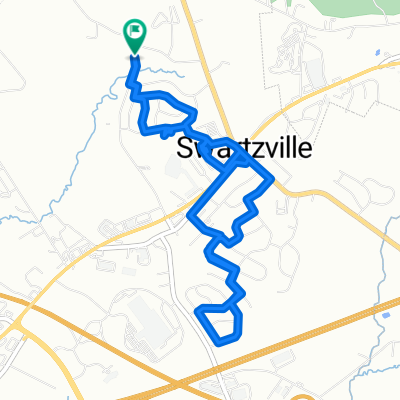
Covered Bridges of Northern Lancaster County
A cycling route starting in Swartzville, Pennsylvania, United States.
Overview
About this route
Covered Bridges Around My House
- -:--
- Duration
- 68 km
- Distance
- 314 m
- Ascent
- 314 m
- Descent
- ---
- Avg. speed
- 174 m
- Max. altitude
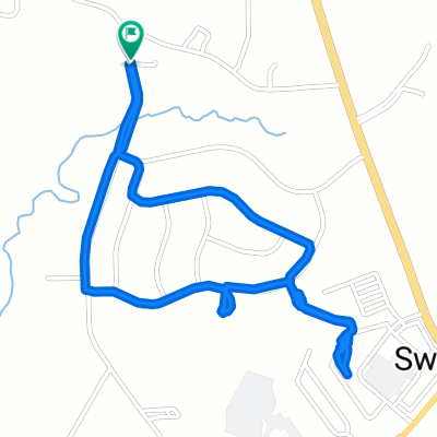
Route photos

Route quality
Waytypes & surfaces along the route
Waytypes
Quiet road
32.7 km
(48 %)
Road
28.8 km
(42 %)
Surfaces
Paved
8.6 km
(13 %)
Unpaved
0.3 km
(<1 %)
Asphalt
8.6 km
(13 %)
Gravel
0.3 km
(<1 %)
Undefined
59.1 km
(87 %)
Continue with Bikemap
Use, edit, or download this cycling route
You would like to ride Covered Bridges of Northern Lancaster County or customize it for your own trip? Here is what you can do with this Bikemap route:
Free features
- Save this route as favorite or in collections
- Copy & plan your own version of this route
- Sync your route with Garmin or Wahoo
Premium features
Free trial for 3 days, or one-time payment. More about Bikemap Premium.
- Navigate this route on iOS & Android
- Export a GPX / KML file of this route
- Create your custom printout (try it for free)
- Download this route for offline navigation
Discover more Premium features.
Get Bikemap PremiumFrom our community
Other popular routes starting in Swartzville
 Ulta (Cologne store)
- Distance
- 18.4 km
- Ascent
- 171 m
- Descent
- 260 m
- Location
- Swartzville, Pennsylvania, United States
 Dirty Dozen
- Distance
- 109.8 km
- Ascent
- 2,829 m
- Descent
- 2,849 m
- Location
- Swartzville, Pennsylvania, United States
 120 Royal Horse Way, Reinholds to 34–42 W Swartzville Rd, Denver
- Distance
- 3.2 km
- Ascent
- 41 m
- Descent
- 48 m
- Location
- Swartzville, Pennsylvania, United States
 Sensenig Hardware
- Distance
- 11.9 km
- Ascent
- 113 m
- Descent
- 150 m
- Location
- Swartzville, Pennsylvania, United States
 Poplar Dr, Denver to Poplar Dr, Denver
- Distance
- 8.3 km
- Ascent
- 87 m
- Descent
- 88 m
- Location
- Swartzville, Pennsylvania, United States
 Adamstown Mohnton Pennwyn Gouglersville
- Distance
- 33.5 km
- Ascent
- 430 m
- Descent
- 432 m
- Location
- Swartzville, Pennsylvania, United States
 Poplar Dr, Denver to Poplar Dr, Denver
- Distance
- 3.3 km
- Ascent
- 49 m
- Descent
- 44 m
- Location
- Swartzville, Pennsylvania, United States
 121 Royal Horse Way, Reinholds to 1665 State Hill Rd, Wyomissing
- Distance
- 17.8 km
- Ascent
- 192 m
- Descent
- 271 m
- Location
- Swartzville, Pennsylvania, United States
Open it in the app