

3napos tervezet 2021
A cycling route starting in Pincehely, Tolna County, Hungary.
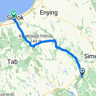
Overview
About this route
Day 1 Pincehely-Szekszárd approx. 56 km
Day 2 Szekszárd-Hajós approx. 65 km
Day 3 Hajós-Soltvadkert approx. 63 km
- -:--
- Duration
- 185.4 km
- Distance
- 274 m
- Ascent
- 268 m
- Descent
- ---
- Avg. speed
- 238 m
- Max. altitude
Route quality
Waytypes & surfaces along the route
Waytypes
Cycleway
31.5 km
(17 %)
Quiet road
22.3 km
(12 %)
Surfaces
Paved
118.7 km
(64 %)
Unpaved
9.3 km
(5 %)
Asphalt
118.7 km
(64 %)
Gravel
9.3 km
(5 %)
Undefined
57.5 km
(31 %)
Continue with Bikemap
Use, edit, or download this cycling route
You would like to ride 3napos tervezet 2021 or customize it for your own trip? Here is what you can do with this Bikemap route:
Free features
- Save this route as favorite or in collections
- Copy & plan your own version of this route
- Split it into stages to create a multi-day tour
- Sync your route with Garmin or Wahoo
Premium features
Free trial for 3 days, or one-time payment. More about Bikemap Premium.
- Navigate this route on iOS & Android
- Export a GPX / KML file of this route
- Create your custom printout (try it for free)
- Download this route for offline navigation
Discover more Premium features.
Get Bikemap PremiumFrom our community
Other popular routes starting in Pincehely
 Pincehely-Nagyszékely-Kisszekely-Ozora
- Distance
- 66.7 km
- Ascent
- 478 m
- Descent
- 482 m
- Location
- Pincehely, Tolna County, Hungary
 Pincehely-Ozora-Tamasi-Pincehely
- Distance
- 48.4 km
- Ascent
- 277 m
- Descent
- 280 m
- Location
- Pincehely, Tolna County, Hungary
 Gárdonyi Géza utca 4., Pincehely to Fő utca 138., Siófok
- Distance
- 48.2 km
- Ascent
- 430 m
- Descent
- 429 m
- Location
- Pincehely, Tolna County, Hungary
 2014 10 09 SImontornya 24,8km
- Distance
- 25.5 km
- Ascent
- 199 m
- Descent
- 229 m
- Location
- Pincehely, Tolna County, Hungary
 Pincehely - Miszla - Kisszekely - Pálfa
- Distance
- 58.2 km
- Ascent
- 425 m
- Descent
- 426 m
- Location
- Pincehely, Tolna County, Hungary
 3napos tervezet 2021
- Distance
- 185.4 km
- Ascent
- 274 m
- Descent
- 268 m
- Location
- Pincehely, Tolna County, Hungary
 2015 11 05 Tolnanémedi 26km
- Distance
- 26.8 km
- Ascent
- 316 m
- Descent
- 316 m
- Location
- Pincehely, Tolna County, Hungary
 Tamási Mezőny Ob U13, WU13, WU15
- Distance
- 15.2 km
- Ascent
- 128 m
- Descent
- 35 m
- Location
- Pincehely, Tolna County, Hungary
Open it in the app