

Lyon Gre par le Vercors
A cycling route starting in Saint-Genis-Laval, Auvergne-Rhône-Alpes, France.
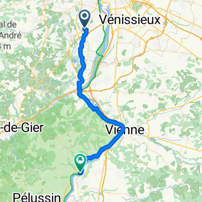
Overview
About this route
August 2004 without training, just the desire to reach the mountain
- -:--
- Duration
- 192 km
- Distance
- 2,299 m
- Ascent
- 2,312 m
- Descent
- ---
- Avg. speed
- ---
- Max. altitude
Route quality
Waytypes & surfaces along the route
Waytypes
Quiet road
25 km
(13 %)
Road
15.4 km
(8 %)
Surfaces
Paved
126.7 km
(66 %)
Unpaved
3.8 km
(2 %)
Asphalt
126.7 km
(66 %)
Unpaved (undefined)
1.9 km
(1 %)
Continue with Bikemap
Use, edit, or download this cycling route
You would like to ride Lyon Gre par le Vercors or customize it for your own trip? Here is what you can do with this Bikemap route:
Free features
- Save this route as favorite or in collections
- Copy & plan your own version of this route
- Split it into stages to create a multi-day tour
- Sync your route with Garmin or Wahoo
Premium features
Free trial for 3 days, or one-time payment. More about Bikemap Premium.
- Navigate this route on iOS & Android
- Export a GPX / KML file of this route
- Create your custom printout (try it for free)
- Download this route for offline navigation
Discover more Premium features.
Get Bikemap PremiumFrom our community
Other popular routes starting in Saint-Genis-Laval
 15) St GenisLaval - Condrieu
- Distance
- 42.1 km
- Ascent
- 156 m
- Descent
- 224 m
- Location
- Saint-Genis-Laval, Auvergne-Rhône-Alpes, France
 Avenue Maréchal Foch 88, Saint-Genis-Laval nach Chemin des Montats 122, Vion
- Distance
- 87.8 km
- Ascent
- 349 m
- Descent
- 437 m
- Location
- Saint-Genis-Laval, Auvergne-Rhône-Alpes, France
 Lyon Gre par le Vercors
- Distance
- 192 km
- Ascent
- 2,299 m
- Descent
- 2,312 m
- Location
- Saint-Genis-Laval, Auvergne-Rhône-Alpes, France
 Tag 32: Saint-Genis-Laval-Condrieu
- Distance
- 38 km
- Ascent
- 284 m
- Descent
- 363 m
- Location
- Saint-Genis-Laval, Auvergne-Rhône-Alpes, France
 15) St GenisLaval - Condrieu
- Distance
- 41.1 km
- Ascent
- 264 m
- Descent
- 333 m
- Location
- Saint-Genis-Laval, Auvergne-Rhône-Alpes, France
 Jakobsweg-04-08-13
- Distance
- 132 km
- Ascent
- 1,363 m
- Descent
- 979 m
- Location
- Saint-Genis-Laval, Auvergne-Rhône-Alpes, France
 SGL
SGL- Distance
- 4.3 km
- Ascent
- 42 m
- Descent
- 49 m
- Location
- Saint-Genis-Laval, Auvergne-Rhône-Alpes, France
 Etapa 081B (Saint Genis Laval - Saint Nazaire en Royans)
- Distance
- 159.3 km
- Ascent
- 674 m
- Descent
- 729 m
- Location
- Saint-Genis-Laval, Auvergne-Rhône-Alpes, France
Open it in the app