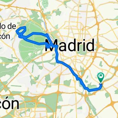
De Calle de Bélmez a Calle de Amparo Usera
- 5.8 km
- 64 m
- 146 m
- Puente de Vallecas, Madrid, Spain
A cycling route starting in Puente de Vallecas, Madrid, Spain.
Overview
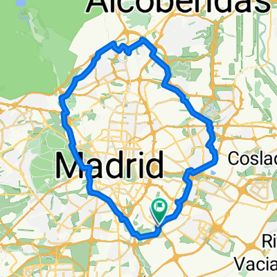
Circular route that includes part of the cycling ring from Entrevías to almost Casa de Campo, branch of Parque de la Cruz Verde, branch of Parque de San Isidro, Paseo de la Chopera, Legazpi, Parque Tierno Galván, and Parque de Entrevías.
created this 17 years ago
Route quality
Cycleway
15.2 km
(50 %)
Quiet road
7.3 km
(24 %)
Paved
14.2 km
(47 %)
Unpaved
0.9 km
(3 %)
Asphalt
12.7 km
(42 %)
Concrete
1.5 km
(5 %)
Route highlights
Inicio-fin de la ruta.
Área de descanso.
Ärea de descanso.
Zona de conflicto. Calzada de un carril y doble sentido, controlado por semáforo. Túnel sin iluminación. Sin carril bici. Acera de menos de un metro y firme muy deteriorado.
FIn de carril bici. La ruta continúa por el interior del Parque Lineal del Manzanares (tiene horario de apertura y cierre).
La ruta abandona el parque y continúa por carril bici.
Área de descanso.
Área de descanso.
Área de descanso.
Zona de conflicto. Pequeño tramo de acera compartido con peatones, hasta sortear la gasolinera.
Área de ejercicios. Subiendo la pequeña colina encontramos elementos para realizar ejercicios y estiramientos.
Área de descanso.
Subida pronunciada junto a la boca de metro de la estación San Francisco, línea 11.
Intercambiador de Aluche.
Zona de conflicto. Tramo a realizar por acera/calzada, hasta llegar al parque.
De nuevo por carril bici.
Abandonamos el anillo ciclista, que continúa ahcia la Casa de Campo, y continuamos por un ramal hacia San Isidro.
La ruta atraviesa todo el Parque de la Cuña Verde.
Zona de conflicto. Extremar la precaución porque, a pesar de ser carril bici único, suele haber bastante gente andando por él.
Bifurcación.
La ruta atraviesa todo el Parque de San Isidro.
Fin del tramo de carril bici. A partir de ahora, la ruta seguirá por calzada.
Tramo por aparcamiento del Cementerio de San Isidro. Superficie adoquinada.
Tramo por calzada.
Puente de Toledo. Superficie adoquinada.
Tramo por calzada.
Matadero-Madrid. Espacio cultural.
Plaza de Legazpi.
Zona de conflicto. Cambiar al carril izquierdo para no entrar en el túnel.
Acceso al Parque Tierno Galván por pequeño túnel.
Zona compartida con peatones.
Fin del tramo por el parque. Inicio de tramo por calzada.
Estación de Autobuses de Méndez Álvaro.
Centro Comercial Hipercor Méndez Álvaro.
Tramo por acera.
Puente de Vallecas.
Seguimos por acera. Precaución si se va por la calzada, pues es una calle de sentido contrario.
Volvemos a la calzada.
Tramo de sentido contrario, pero poco transitado.
Precaución en este cruce. Salida directa a la M-30.
La calzada ya es de doble sentido.
Cruce bajo túnel.
Precaución en este cruce.
Zona con buenas vistas del sur de Madrid.
A lo largo del Parque Lineal de Entrevías hay un carril bici más o menos paralelo a la carretera.
Tramo de carril bici, pero en muy mal estado.
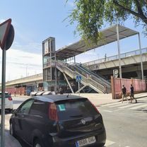
Estación de Cercanías "El Pozo".
Continue with Bikemap
You would like to ride Parques del Sur or customize it for your own trip? Here is what you can do with this Bikemap route:
Free trial for 3 days, or one-time payment. More about Bikemap Premium.
Discover more Premium features.
Get Bikemap PremiumFrom our community
Open it in the app