

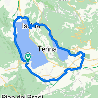
Caldonazzo - Trient dirket
A cycling route starting in Calceranica al Lago, Trentino-Alto Adige, Italy.
Overview
About this route
- -:--
- Duration
- 21.6 km
- Distance
- 137 m
- Ascent
- 382 m
- Descent
- ---
- Avg. speed
- 497 m
- Max. altitude

Route quality
Waytypes & surfaces along the route
Waytypes
Quiet road
6.7 km
(31 %)
Road
6 km
(28 %)
Surfaces
Paved
20.1 km
(93 %)
Asphalt
19.8 km
(92 %)
Wood
0.2 km
(1 %)
Undefined
1.5 km
(7 %)
Continue with Bikemap
Use, edit, or download this cycling route
You would like to ride Caldonazzo - Trient dirket or customize it for your own trip? Here is what you can do with this Bikemap route:
Free features
- Save this route as favorite or in collections
- Copy & plan your own version of this route
- Sync your route with Garmin or Wahoo
Premium features
Free trial for 3 days, or one-time payment. More about Bikemap Premium.
- Navigate this route on iOS & Android
- Export a GPX / KML file of this route
- Create your custom printout (try it for free)
- Download this route for offline navigation
Discover more Premium features.
Get Bikemap PremiumFrom our community
Other popular routes starting in Calceranica al Lago
 ciclabile del brenta da caldonazzo a bassano del grappa
- Distance
- 72.4 km
- Ascent
- 155 m
- Descent
- 489 m
- Location
- Calceranica al Lago, Trentino-Alto Adige, Italy
 valsugana
- Distance
- 77.7 km
- Ascent
- 214 m
- Descent
- 558 m
- Location
- Calceranica al Lago, Trentino-Alto Adige, Italy
 Viale Trento, Calceranica al Lago nach Viale Trento, Calceranica al Lago
- Distance
- 21 km
- Ascent
- 344 m
- Descent
- 342 m
- Location
- Calceranica al Lago, Trentino-Alto Adige, Italy
 IT - Caldonazzo - Borgo - Malga Costa
- Distance
- 48 km
- Ascent
- 735 m
- Descent
- 736 m
- Location
- Calceranica al Lago, Trentino-Alto Adige, Italy
 Caldonazzo - Trient dirket
- Distance
- 21.6 km
- Ascent
- 137 m
- Descent
- 382 m
- Location
- Calceranica al Lago, Trentino-Alto Adige, Italy
 Von Selva di Levico nach Bassano del Grappa
- Distance
- 75 km
- Ascent
- 297 m
- Descent
- 648 m
- Location
- Calceranica al Lago, Trentino-Alto Adige, Italy
 Kaiserjager rondje 40km
- Distance
- 39.5 km
- Ascent
- 1,062 m
- Descent
- 1,062 m
- Location
- Calceranica al Lago, Trentino-Alto Adige, Italy
 dal lago,alla montagna.
- Distance
- 41.6 km
- Ascent
- 1,347 m
- Descent
- 1,103 m
- Location
- Calceranica al Lago, Trentino-Alto Adige, Italy
Open it in the app