
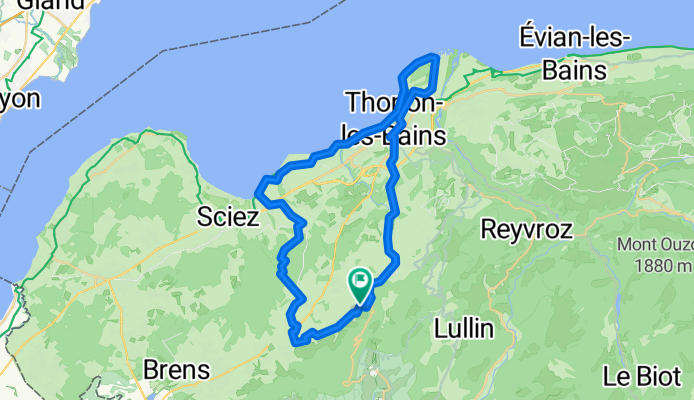
Cursignes - Chateau Ripaille -Cursinges
A cycling route starting in Perrignier, Auvergne-Rhône-Alpes, France.
Overview
About this route
Une bonne partie sur la route, quelques chemins forestiers. VTT indispensable.
- -:--
- Duration
- 43.3 km
- Distance
- 393 m
- Ascent
- 393 m
- Descent
- ---
- Avg. speed
- ---
- Max. altitude
Route quality
Waytypes & surfaces along the route
Waytypes
Quiet road
13 km
(30 %)
Road
7.7 km
(18 %)
Surfaces
Paved
26.2 km
(60 %)
Unpaved
6 km
(14 %)
Asphalt
26 km
(60 %)
Ground
4.3 km
(10 %)
Continue with Bikemap
Use, edit, or download this cycling route
You would like to ride Cursignes - Chateau Ripaille -Cursinges or customize it for your own trip? Here is what you can do with this Bikemap route:
Free features
- Save this route as favorite or in collections
- Copy & plan your own version of this route
- Sync your route with Garmin or Wahoo
Premium features
Free trial for 3 days, or one-time payment. More about Bikemap Premium.
- Navigate this route on iOS & Android
- Export a GPX / KML file of this route
- Create your custom printout (try it for free)
- Download this route for offline navigation
Discover more Premium features.
Get Bikemap PremiumFrom our community
Other popular routes starting in Perrignier
 Perrignier Cycling
- Distance
- 32.7 km
- Ascent
- 1,016 m
- Descent
- 1,007 m
- Location
- Perrignier, Auvergne-Rhône-Alpes, France
 Perrignier Allinges Sciez Bons en Chablais
- Distance
- 38.7 km
- Ascent
- 500 m
- Descent
- 502 m
- Location
- Perrignier, Auvergne-Rhône-Alpes, France
 EDT 2023 - coupe Feu
- Distance
- 9.7 km
- Ascent
- 182 m
- Descent
- 201 m
- Location
- Perrignier, Auvergne-Rhône-Alpes, France
 Cursignes - Chateau Ripaille -Cursinges
- Distance
- 43.3 km
- Ascent
- 393 m
- Descent
- 393 m
- Location
- Perrignier, Auvergne-Rhône-Alpes, France
 DAY 23
- Distance
- 206.2 km
- Ascent
- 2,176 m
- Descent
- 2,425 m
- Location
- Perrignier, Auvergne-Rhône-Alpes, France
 Draillant - Col de Cou
- Distance
- 9.5 km
- Ascent
- 558 m
- Descent
- 63 m
- Location
- Perrignier, Auvergne-Rhône-Alpes, France
 Parcours détendu
- Distance
- 51 km
- Ascent
- 755 m
- Descent
- 846 m
- Location
- Perrignier, Auvergne-Rhône-Alpes, France
 De 2620 Route du Col, Habère-Poche à 2861–2899 Route du Col du Feu, Lullin
- Distance
- 10.6 km
- Ascent
- 433 m
- Descent
- 373 m
- Location
- Perrignier, Auvergne-Rhône-Alpes, France
Open it in the app