

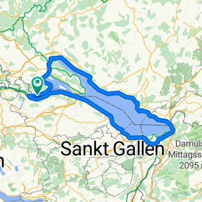
Öhningen Ramsen Buch Hemishofen Öhningen
A cycling route starting in Öhningen, Baden-Wurttemberg, Germany.
Overview
About this route
A really beautiful tour, partly on little-known and used paths.
At one point, at km 16, you have to push 100 m in the forest without a path uphill.
A little later, you are rewarded with a great view at a hut/barbecue area on the Ramsenblickweg.
- -:--
- Duration
- 32.4 km
- Distance
- 349 m
- Ascent
- 349 m
- Descent
- ---
- Avg. speed
- ---
- Max. altitude
Continue with Bikemap
Use, edit, or download this cycling route
You would like to ride Öhningen Ramsen Buch Hemishofen Öhningen or customize it for your own trip? Here is what you can do with this Bikemap route:
Free features
- Save this route as favorite or in collections
- Copy & plan your own version of this route
- Sync your route with Garmin or Wahoo
Premium features
Free trial for 3 days, or one-time payment. More about Bikemap Premium.
- Navigate this route on iOS & Android
- Export a GPX / KML file of this route
- Create your custom printout (try it for free)
- Download this route for offline navigation
Discover more Premium features.
Get Bikemap PremiumFrom our community
Other popular routes starting in Öhningen
 Oner und Untersee
- Distance
- 161.8 km
- Ascent
- 399 m
- Descent
- 403 m
- Location
- Öhningen, Baden-Wurttemberg, Germany
 Öhningen Ramsen Buch Hemishofen Öhningen
- Distance
- 32.4 km
- Ascent
- 349 m
- Descent
- 349 m
- Location
- Öhningen, Baden-Wurttemberg, Germany
 MTB Tour Schiener Berg
- Distance
- 27.1 km
- Ascent
- 780 m
- Descent
- 777 m
- Location
- Öhningen, Baden-Wurttemberg, Germany
 Bodensee Umrundung
- Distance
- 197.3 km
- Ascent
- 765 m
- Descent
- 791 m
- Location
- Öhningen, Baden-Wurttemberg, Germany
 Öhningen-Klingenzell-Mammern und zurück
- Distance
- 18.6 km
- Ascent
- 303 m
- Descent
- 303 m
- Location
- Öhningen, Baden-Wurttemberg, Germany
 Bodensee Rund um den Untersee
- Distance
- 72.3 km
- Ascent
- 128 m
- Descent
- 130 m
- Location
- Öhningen, Baden-Wurttemberg, Germany
 Zum Rheinfall
- Distance
- 29.2 km
- Ascent
- 193 m
- Descent
- 216 m
- Location
- Öhningen, Baden-Wurttemberg, Germany
 Stein am Rhein-Padova
- Distance
- 579.3 km
- Ascent
- 3,668 m
- Descent
- 4,076 m
- Location
- Öhningen, Baden-Wurttemberg, Germany
Open it in the app