

Historischer Stadtkern Kalkar. Eine Rundtour
A cycling route starting in Kalkar, North Rhine-Westphalia, Germany.
Overview
About this route
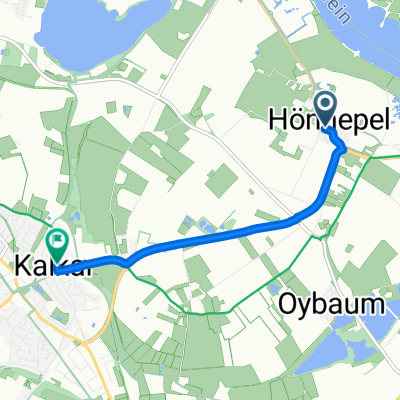
Die 33 Kilometer lange Rundtour mit dem Start- und Zielort Kalkar führt durch weite Felder und Wiesen, entlang des Rheins, bietet Stippvisiten in Dörfern mit baukulturellen Kleinoden und macht einen Abstecher zum Museum Schloss Moyland.
- -:--
- Duration
- 39.7 km
- Distance
- 137 m
- Ascent
- 135 m
- Descent
- ---
- Avg. speed
- 52 m
- Max. altitude

Route quality
Waytypes & surfaces along the route
Waytypes
Path
16.8 km
(42 %)
Quiet road
8.2 km
(21 %)
Surfaces
Paved
24.6 km
(62 %)
Unpaved
0.1 km
(<1 %)
Asphalt
19.2 km
(48 %)
Paving stones
3.5 km
(9 %)
Continue with Bikemap
Use, edit, or download this cycling route
You would like to ride Historischer Stadtkern Kalkar. Eine Rundtour or customize it for your own trip? Here is what you can do with this Bikemap route:
Free features
- Save this route as favorite or in collections
- Copy & plan your own version of this route
- Sync your route with Garmin or Wahoo
Premium features
Free trial for 3 days, or one-time payment. More about Bikemap Premium.
- Navigate this route on iOS & Android
- Export a GPX / KML file of this route
- Create your custom printout (try it for free)
- Download this route for offline navigation
Discover more Premium features.
Get Bikemap PremiumFrom our community
Other popular routes starting in Kalkar
 Von Kalkar bis Rees
- Distance
- 7.4 km
- Ascent
- 6 m
- Descent
- 0 m
- Location
- Kalkar, North Rhine-Westphalia, Germany
 Appeldorn-Ginderich-Xanten-Appeldorn
- Distance
- 54.1 km
- Ascent
- 69 m
- Descent
- 67 m
- Location
- Kalkar, North Rhine-Westphalia, Germany
 Route zu Wunderland, Wisseler See, Kalkar Marktplatz, Mühle
- Distance
- 12 km
- Ascent
- 7 m
- Descent
- 7 m
- Location
- Kalkar, North Rhine-Westphalia, Germany
 Route zu Kalkar Marktplatz
- Distance
- 4.2 km
- Ascent
- 3 m
- Descent
- 0 m
- Location
- Kalkar, North Rhine-Westphalia, Germany
 Route Zevenaar
- Distance
- 70 km
- Ascent
- 210 m
- Descent
- 209 m
- Location
- Kalkar, North Rhine-Westphalia, Germany
 Gartentour Kleverland
- Distance
- 42.1 km
- Ascent
- 77 m
- Descent
- 77 m
- Location
- Kalkar, North Rhine-Westphalia, Germany
 Kalkar-Moyland- Rees-Bislich-Xanten-Kalkar
- Distance
- 62.2 km
- Ascent
- 45 m
- Descent
- 53 m
- Location
- Kalkar, North Rhine-Westphalia, Germany
 Moyland-Kalkar-Xanten-Rees-Moyland CLONED FROM ROUTE 157879
- Distance
- 62.3 km
- Ascent
- 40 m
- Descent
- 40 m
- Location
- Kalkar, North Rhine-Westphalia, Germany
Open it in the app