Ruinenrunde_Rauhenstein_Rauheneck
A cycling route starting in Gaaden, Lower Austria, Austria.
Overview
About this route
- -:--
- Duration
- 17.4 km
- Distance
- 391 m
- Ascent
- 392 m
- Descent
- ---
- Avg. speed
- ---
- Avg. speed
Continue with Bikemap
Use, edit, or download this cycling route
You would like to ride Ruinenrunde_Rauhenstein_Rauheneck or customize it for your own trip? Here is what you can do with this Bikemap route:
Free features
- Save this route as favorite or in collections
- Copy & plan your own version of this route
- Sync your route with Garmin or Wahoo
Premium features
Free trial for 3 days, or one-time payment. More about Bikemap Premium.
- Navigate this route on iOS & Android
- Export a GPX / KML file of this route
- Create your custom printout (try it for free)
- Download this route for offline navigation
Discover more Premium features.
Get Bikemap PremiumFrom our community
Other popular routes starting in Gaaden
- Hocheck-Schöpflrunde
- Distance
- 92.5 km
- Ascent
- 1,393 m
- Descent
- 1,393 m
- Location
- Gaaden, Lower Austria, Austria
- Anninger Trophy ohne Wilhelmswarte
- Distance
- 5.7 km
- Ascent
- 353 m
- Descent
- 20 m
- Location
- Gaaden, Lower Austria, Austria
- Ruinenrunde_Rauhenstein_Rauheneck
- Distance
- 17.4 km
- Ascent
- 391 m
- Descent
- 392 m
- Location
- Gaaden, Lower Austria, Austria
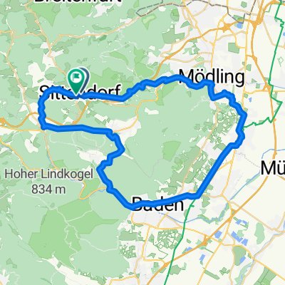
- Hauptstraße 1a/1, Gaaden nach Hauptstraße 1a/1, Gaaden
- Distance
- 31 km
- Ascent
- 1,060 m
- Descent
- 1,061 m
- Location
- Gaaden, Lower Austria, Austria
- Siegenfeld Runde 2
- Distance
- 10.4 km
- Ascent
- 194 m
- Descent
- 197 m
- Location
- Gaaden, Lower Austria, Austria
- Wienerwaldrunde 10. Mai 09
- Distance
- 42.9 km
- Ascent
- 631 m
- Descent
- 661 m
- Location
- Gaaden, Lower Austria, Austria
- Siegenfeld_Weißes Kreuz_Rosenthal
- Distance
- 15.6 km
- Ascent
- 369 m
- Descent
- 371 m
- Location
- Gaaden, Lower Austria, Austria
- Krainerhütte - Schwechat
- Distance
- 67.5 km
- Ascent
- 188 m
- Descent
- 298 m
- Location
- Gaaden, Lower Austria, Austria
Open it in the app