
Covered Bridges of Franklin Cty MAss - 4
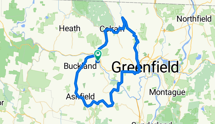
A cycling route starting in Shelburne Falls, Massachusetts, United States.
Overview
About this route
- -:--
- Duration
- 78.1 km
- Distance
- 777 m
- Ascent
- 776 m
- Descent
- ---
- Avg. speed
- 397 m
- Max. altitude

Route quality
Waytypes & surfaces along the route
Waytypes
Busy road
33.7 km
(43 %)
Road
27.3 km
(35 %)
Surfaces
Paved
52.1 km
(67 %)
Unpaved
6.9 km
(9 %)
Asphalt
50.8 km
(65 %)
Gravel
6.9 km
(9 %)
Route highlights
Points of interest along the route
Point of interest after 8.4 km
Arthur A smith Bridge
Point of interest after 26.3 km
Pumping Station Covered Bridge
Point of interest after 33.9 km
Gilbertville (Ware) Covered Bridge
Point of interest after 50.9 km
Burkeville Bridge
Point of interest after 60 km
Creamery Bridge
Point of interest after 64.5 km
Upper Sheffield Bridge
Point of interest after 69.2 km
Bissell Bridge
Continue with Bikemap
Use, edit, or download this cycling route
You would like to ride Covered Bridges of Franklin Cty MAss - 4 or customize it for your own trip? Here is what you can do with this Bikemap route:
Free features
- Save this route as favorite or in collections
- Copy & plan your own version of this route
- Sync your route with Garmin or Wahoo
Premium features
Free trial for 3 days, or one-time payment. More about Bikemap Premium.
- Navigate this route on iOS & Android
- Export a GPX / KML file of this route
- Create your custom printout (try it for free)
- Download this route for offline navigation
Discover more Premium features.
Get Bikemap PremiumFrom our community
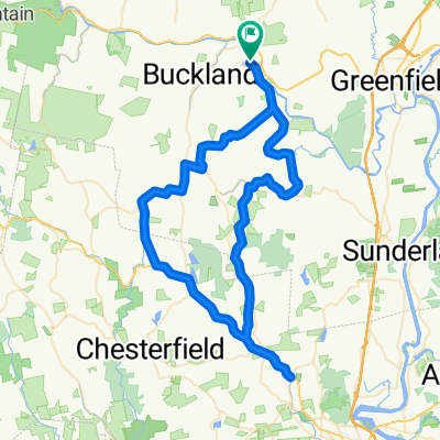
Other popular routes starting in Shelburne Falls
 hymff
hymff- Distance
- 46.6 km
- Ascent
- 586 m
- Descent
- 563 m
- Location
- Shelburne Falls, Massachusetts, United States
 Deerfield River Tour
- Distance
- 92.1 km
- Ascent
- 1,028 m
- Descent
- 1,026 m
- Location
- Shelburne Falls, Massachusetts, United States
 Sunday Morning Ride 7-6-2008
- Distance
- 80 km
- Ascent
- 1,193 m
- Descent
- 1,180 m
- Location
- Shelburne Falls, Massachusetts, United States
 July 1 2008
- Distance
- 80 km
- Ascent
- 1,592 m
- Descent
- 1,574 m
- Location
- Shelburne Falls, Massachusetts, United States
 Shelburne Falls Figure Eight
- Distance
- 76.3 km
- Ascent
- 1,015 m
- Descent
- 1,015 m
- Location
- Shelburne Falls, Massachusetts, United States
 Shelburne Falls Figure Eight loop: serious hills
- Distance
- 76.3 km
- Ascent
- 952 m
- Descent
- 952 m
- Location
- Shelburne Falls, Massachusetts, United States
 Mohawk Tail from Shelburne Falls to North Adams, MA
- Distance
- 44.4 km
- Ascent
- 569 m
- Descent
- 507 m
- Location
- Shelburne Falls, Massachusetts, United States
 Covered Bridges of Franklin Cty MAss - 4
- Distance
- 78.1 km
- Ascent
- 777 m
- Descent
- 776 m
- Location
- Shelburne Falls, Massachusetts, United States
Open it in the app