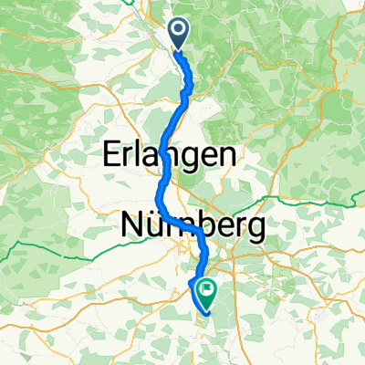
Buttenheim-Strullendorfer Keller-RMD-Kanal-Hirschaid-Altendorf -Buttenheim
A cycling route starting in Buttenheim, Bavaria, Germany.
Overview
About this route
Rundkurs am Kanal entlang
- -:--
- Duration
- 18.2 km
- Distance
- 140 m
- Ascent
- 142 m
- Descent
- ---
- Avg. speed
- ---
- Avg. speed
Continue with Bikemap
Use, edit, or download this cycling route
You would like to ride Buttenheim-Strullendorfer Keller-RMD-Kanal-Hirschaid-Altendorf -Buttenheim or customize it for your own trip? Here is what you can do with this Bikemap route:
Free features
- Save this route as favorite or in collections
- Copy & plan your own version of this route
- Sync your route with Garmin or Wahoo
Premium features
Free trial for 3 days, or one-time payment. More about Bikemap Premium.
- Navigate this route on iOS & Android
- Export a GPX / KML file of this route
- Create your custom printout (try it for free)
- Download this route for offline navigation
Discover more Premium features.
Get Bikemap PremiumFrom our community
Other popular routes starting in Buttenheim
- Buttenheim-Rothenburg o d T-Großeicholzheim
- Distance
- 198.9 km
- Ascent
- 1,155 m
- Descent
- 1,138 m
- Location
- Buttenheim, Bavaria, Germany
- Von Buttenheim bis Bamberg
- Distance
- 37.5 km
- Ascent
- 204 m
- Descent
- 222 m
- Location
- Buttenheim, Bavaria, Germany
- Rundkurs Schießberg-Senftenberg-Almadler-Kalteneggolsfeld-TiefenstürmigKautschenberg-Gunzendorf-Dreuschendorf-Buttenheim
- Distance
- 31.7 km
- Ascent
- 593 m
- Descent
- 598 m
- Location
- Buttenheim, Bavaria, Germany
- Kanal-Strullendorf-Amlingstadt-Wernsdorf-Leesten-Friesen-Buttenheim
- Distance
- 25.5 km
- Ascent
- 305 m
- Descent
- 297 m
- Location
- Buttenheim, Bavaria, Germany
- sonntagsrunde friesener warte
- Distance
- 9.6 km
- Ascent
- 460 m
- Descent
- 477 m
- Location
- Buttenheim, Bavaria, Germany
- Buttenheim-Leinleitertal und zurück
- Distance
- 47.7 km
- Ascent
- 648 m
- Descent
- 559 m
- Location
- Buttenheim, Bavaria, Germany
- Buttenheim-Burker Wald-Baggersee Altendorf
- Distance
- 40.2 km
- Ascent
- 275 m
- Descent
- 272 m
- Location
- Buttenheim, Bavaria, Germany
- Bamberg MTB 2
- Distance
- 43.8 km
- Ascent
- 1,038 m
- Descent
- 931 m
- Location
- Buttenheim, Bavaria, Germany
Open it in the app