
RV_GehrenbergTurm_RV
A cycling route starting in Ravensburg, Baden-Wurttemberg, Germany.
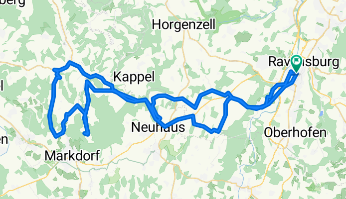
Overview
About this route
Beautiful view from the Gehrenberg Tower over Markdorf, the lake, and the landscape. The approach via Wendlingen is moderate.
- -:--
- Duration
- 62.8 km
- Distance
- 462 m
- Ascent
- 464 m
- Descent
- ---
- Avg. speed
- ---
- Max. altitude

Route quality
Waytypes & surfaces along the route
Waytypes
Quiet road
19.5 km
(31 %)
Road
16.3 km
(26 %)
Surfaces
Paved
54.6 km
(87 %)
Asphalt
54.6 km
(87 %)
Undefined
8.2 km
(13 %)
Route highlights
Points of interest along the route

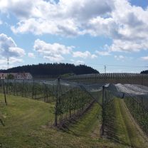
Point of interest after 37.1 km
Der Turm.

Point of interest after 38 km
Kurz vor dem Ziel.. der Gehrenbergturm.
Continue with Bikemap
Use, edit, or download this cycling route
You would like to ride RV_GehrenbergTurm_RV or customize it for your own trip? Here is what you can do with this Bikemap route:
Free features
- Save this route as favorite or in collections
- Copy & plan your own version of this route
- Sync your route with Garmin or Wahoo
Premium features
Free trial for 3 days, or one-time payment. More about Bikemap Premium.
- Navigate this route on iOS & Android
- Export a GPX / KML file of this route
- Create your custom printout (try it for free)
- Download this route for offline navigation
Discover more Premium features.
Get Bikemap PremiumFrom our community
Other popular routes starting in Ravensburg
 Von Ravensburg nach Meersburg
- Distance
- 29.6 km
- Ascent
- 264 m
- Descent
- 288 m
- Location
- Ravensburg, Baden-Wurttemberg, Germany
 Ravensburg - Obereisenbach - Ettenkirchen - Runde
- Distance
- 40.6 km
- Ascent
- 470 m
- Descent
- 476 m
- Location
- Ravensburg, Baden-Wurttemberg, Germany
 20110507_RV_Deggenhausen_Illmensee_RV
- Distance
- 68.8 km
- Ascent
- 437 m
- Descent
- 436 m
- Location
- Ravensburg, Baden-Wurttemberg, Germany
 RV_Ailinger Kapelle_Eriskirch_RV
- Distance
- 58.5 km
- Ascent
- 287 m
- Descent
- 286 m
- Location
- Ravensburg, Baden-Wurttemberg, Germany
 RV_Kressbronn_Selmnau_Tettnang_RV
- Distance
- 54.7 km
- Ascent
- 366 m
- Descent
- 366 m
- Location
- Ravensburg, Baden-Wurttemberg, Germany
 Von Ravensburg nach Friedrichshafen - Sommerweg
- Distance
- 20.5 km
- Ascent
- 68 m
- Descent
- 94 m
- Location
- Ravensburg, Baden-Wurttemberg, Germany
 Von Ravensburg zum Pfrunger Ried
- Distance
- 75.9 km
- Ascent
- 494 m
- Descent
- 494 m
- Location
- Ravensburg, Baden-Wurttemberg, Germany
 Einfache Fahrt Ravensburg im Schußental
- Distance
- 25.1 km
- Ascent
- 652 m
- Descent
- 652 m
- Location
- Ravensburg, Baden-Wurttemberg, Germany
Open it in the app