
Mazza 3 - Bocaina
A cycling route starting in Valinhos, São Paulo, Brazil.
Overview
About this route
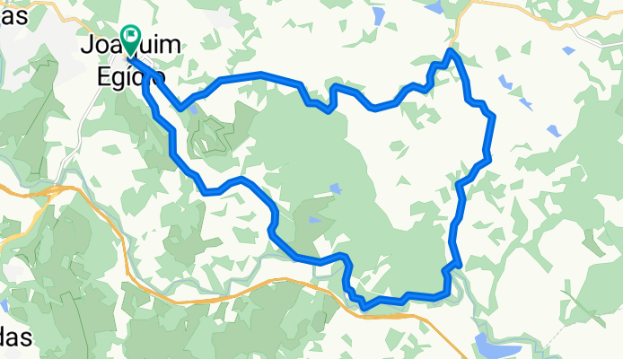
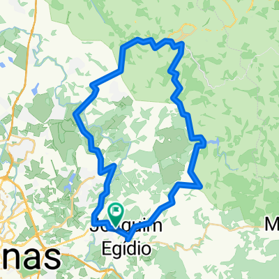
Route: Starts from the abandoned gas station in Joaquim Egídio. The best trail, despite being short. Not tough in terms of climbs. Passes through very beautiful places and also through wooded areas and along the riverbank. Several technical points (as Gustavo said). Very good.
- -:--
- Duration
- 25.4 km
- Distance
- 413 m
- Ascent
- 413 m
- Descent
- ---
- Avg. speed
- ---
- Max. altitude

Route quality
Waytypes & surfaces along the route
Waytypes
Road
12.7 km
(50 %)
Track
2 km
(8 %)
Surfaces
Paved
9.7 km
(38 %)
Unpaved
15.8 km
(62 %)
Ground
15.8 km
(62 %)
Asphalt
9.7 km
(38 %)
Route highlights
Points of interest along the route
Point of interest after 10.9 km
Descida animal. Solte com cuidado o breque. Ela vai longe em terreno irregular.
Point of interest after 15.3 km
Começa mais ou menos por aqui, e até uns 3 km a trilha é realmente muito bonita. Vai no meio de árvores e passa por uns locais de boa dificuldade no meio de pedras. Quando chove é DEZ.
Point of interest after 24 km
Depois de um tempo subindo, esta descida final cai muito bem. Com cascalho, pode escorregar, mas solte o breque com cuidado.
Continue with Bikemap
Use, edit, or download this cycling route
You would like to ride Mazza 3 - Bocaina or customize it for your own trip? Here is what you can do with this Bikemap route:
Free features
- Save this route as favorite or in collections
- Copy & plan your own version of this route
- Sync your route with Garmin or Wahoo
Premium features
Free trial for 3 days, or one-time payment. More about Bikemap Premium.
- Navigate this route on iOS & Android
- Export a GPX / KML file of this route
- Create your custom printout (try it for free)
- Download this route for offline navigation
Discover more Premium features.
Get Bikemap PremiumFrom our community
Other popular routes starting in Valinhos
 Trilha | JE - Vicentão - Pedreira-Pastinho-C. Médicos-Sousas
- Distance
- 56.9 km
- Ascent
- 651 m
- Descent
- 651 m
- Location
- Valinhos, São Paulo, Brazil
 Joaquim Egídio - Monte Alegre do Sul
- Distance
- 52.8 km
- Ascent
- 843 m
- Descent
- 766 m
- Location
- Valinhos, São Paulo, Brazil
 Mazza 3 - Bocaina
- Distance
- 25.4 km
- Ascent
- 413 m
- Descent
- 413 m
- Location
- Valinhos, São Paulo, Brazil
 Posto Desativado - Bar do Vicente - Antena da Embratel - Feijão - Posto
- Distance
- 41.1 km
- Ascent
- 600 m
- Descent
- 600 m
- Location
- Valinhos, São Paulo, Brazil
 Rota para Rodovia Jose Bonifacio Coutinho Nogueira, 1716, Campinas
- Distance
- 25.4 km
- Ascent
- 671 m
- Descent
- 686 m
- Location
- Valinhos, São Paulo, Brazil
 Bocaina
- Distance
- 26 km
- Ascent
- 411 m
- Descent
- 410 m
- Location
- Valinhos, São Paulo, Brazil
 Valinhos Abismo Valinhos
- Distance
- 20.5 km
- Ascent
- 436 m
- Descent
- 437 m
- Location
- Valinhos, São Paulo, Brazil
 Mazza 13 - Erro
- Distance
- 45.2 km
- Ascent
- 806 m
- Descent
- 806 m
- Location
- Valinhos, São Paulo, Brazil
Open it in the app