

Zum Großglockner
A cycling route starting in Flachau, Salzburg, Austria.
Overview
About this route
Charakteristik:
Die Königstour zur Großglockner Hochalpenstraße! Ziel ist das Hochtor auf 2.503 Meter Seehöhe.
Ausgangs- und Zielpunkt:
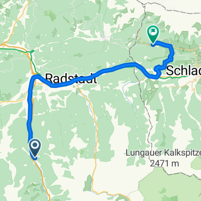
Tourismusinformation Flachau
Streckenverlauf:
Start Tourismusinfo Flachau - auf der Dorfstraße Flachau zum Kreisverkehr am Ortseingang von Flachau - beim Kreisverkehr dritte Ausfahrt Richtung Wagrain - nach ca. 200 Metern beim nächsten Kreisverkehr gerade durch (zweite Ausfahrt) auf die Wagrainer Bundesstraße Richtung Wagrain/St. Johann - in St. Johann links Richtung Zell am See - über Schwarzach/St. Veit und Taxenbach bis nach Bruck an der Glocknerstraße - in Bruck an der Glocknerstraße links Richtung Großglockner Hochalpenstraße - langer Anstieg bis zum Hochtor auf 2.503 Meter Seehöhe - dieselbe Strecke wieder retour nach Flachau
- -:--
- Duration
- 175.5 km
- Distance
- 2,424 m
- Ascent
- 2,424 m
- Descent
- ---
- Avg. speed
- ---
- Max. altitude

Route quality
Waytypes & surfaces along the route
Waytypes
Road
94.8 km
(54 %)
Cycleway
7 km
(4 %)
Surfaces
Paved
158 km
(90 %)
Asphalt
158 km
(90 %)
Undefined
17.6 km
(10 %)
Route highlights
Points of interest along the route

Photo after 86.3 km
Hochtor - 2.503 Meter Seehöhe
Drinking water after 175.5 km
Fun & Pro Bikezentrum: geführte Touren, Bikeverleih und -transport
Continue with Bikemap
Use, edit, or download this cycling route
You would like to ride Zum Großglockner or customize it for your own trip? Here is what you can do with this Bikemap route:
Free features
- Save this route as favorite or in collections
- Copy & plan your own version of this route
- Split it into stages to create a multi-day tour
- Sync your route with Garmin or Wahoo
Premium features
Free trial for 3 days, or one-time payment. More about Bikemap Premium.
- Navigate this route on iOS & Android
- Export a GPX / KML file of this route
- Create your custom printout (try it for free)
- Download this route for offline navigation
Discover more Premium features.
Get Bikemap PremiumFrom our community
Other popular routes starting in Flachau
 Amadé Radmarathon - B Strecke
- Distance
- 99.5 km
- Ascent
- 0 m
- Descent
- 0 m
- Location
- Flachau, Salzburg, Austria
 Marbachalmen
- Distance
- 26.1 km
- Ascent
- 352 m
- Descent
- 352 m
- Location
- Flachau, Salzburg, Austria
 Flachau - Marbachalm
- Distance
- 13.1 km
- Ascent
- 375 m
- Descent
- 57 m
- Location
- Flachau, Salzburg, Austria
 Altenmarkt - Königlehen - Radstadt
- Distance
- 28.8 km
- Ascent
- 0 m
- Descent
- 0 m
- Location
- Flachau, Salzburg, Austria
 Altenmarkt - Steinwand - Sattelbauer
- Distance
- 29.2 km
- Ascent
- 1,003 m
- Descent
- 1,003 m
- Location
- Flachau, Salzburg, Austria
 Runde: Moadörfl Wagrain, Kleinarl Steinkaralm, Jägersee, Wagrain
- Distance
- 47.6 km
- Ascent
- 2,484 m
- Descent
- 2,484 m
- Location
- Flachau, Salzburg, Austria
 EnnsRadweg1
- Distance
- 37.8 km
- Ascent
- 478 m
- Descent
- 342 m
- Location
- Flachau, Salzburg, Austria
 Aigenberg
- Distance
- 21.4 km
- Ascent
- 498 m
- Descent
- 498 m
- Location
- Flachau, Salzburg, Austria
Open it in the app