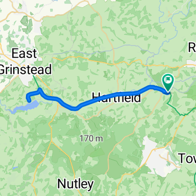
Forest Way
A cycling route starting in Rusthall, England, United Kingdom.
Overview
About this route
- -:--
- Duration
- 16.5 km
- Distance
- 128 m
- Ascent
- 59 m
- Descent
- ---
- Avg. speed
- 135 m
- Max. altitude
Route quality
Waytypes & surfaces along the route
Waytypes
Cycleway
14.5 km
(88 %)
Road
1.5 km
(9 %)
Surfaces
Paved
3.6 km
(22 %)
Unpaved
12.8 km
(78 %)
Gravel
12.7 km
(77 %)
Asphalt
3.6 km
(22 %)
Continue with Bikemap
Use, edit, or download this cycling route
You would like to ride Forest Way or customize it for your own trip? Here is what you can do with this Bikemap route:
Free features
- Save this route as favorite or in collections
- Copy & plan your own version of this route
- Sync your route with Garmin or Wahoo
Premium features
Free trial for 3 days, or one-time payment. More about Bikemap Premium.
- Navigate this route on iOS & Android
- Export a GPX / KML file of this route
- Create your custom printout (try it for free)
- Download this route for offline navigation
Discover more Premium features.
Get Bikemap PremiumFrom our community
Other popular routes starting in Rusthall
- Capt.Tom 100 Challenge
- Distance
- 36.5 km
- Ascent
- 437 m
- Descent
- 520 m
- Location
- Rusthall, England, United Kingdom
- PORC CX Race 27/11/2011
- Distance
- 3 km
- Ascent
- 77 m
- Descent
- 78 m
- Location
- Rusthall, England, United Kingdom
- Langton, Penshurst, Pembury
- Distance
- 31.3 km
- Ascent
- 296 m
- Descent
- 297 m
- Location
- Rusthall, England, United Kingdom
- Forest Way - (Groombridge to Forest Row)
- Distance
- 23 km
- Ascent
- 76 m
- Descent
- 76 m
- Location
- Rusthall, England, United Kingdom
- Forgewood Loop and Ditchling
- Distance
- 108.4 km
- Ascent
- 922 m
- Descent
- 922 m
- Location
- Rusthall, England, United Kingdom
- groomridge loop 1
- Distance
- 38.4 km
- Ascent
- 423 m
- Descent
- 397 m
- Location
- Rusthall, England, United Kingdom
- Avenue Verte_3
- Distance
- 67 km
- Ascent
- 378 m
- Descent
- 422 m
- Location
- Rusthall, England, United Kingdom
- Around Penshurst
- Distance
- 15 km
- Ascent
- 194 m
- Descent
- 196 m
- Location
- Rusthall, England, United Kingdom
Open it in the app