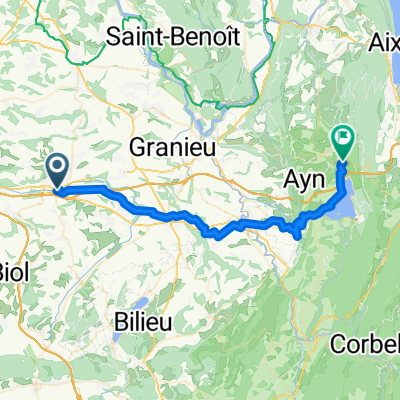
La Tour du pin - St Sorlin
A cycling route starting in La Tour-du-Pin, Auvergne-Rhône-Alpes, France.
Overview
About this route
- -:--
- Duration
- 11.2 km
- Distance
- 156 m
- Ascent
- 227 m
- Descent
- ---
- Avg. speed
- ---
- Max. altitude
Route quality
Waytypes & surfaces along the route
Waytypes
Busy road
8 km
(72 %)
Quiet road
2.5 km
(23 %)
Surfaces
Paved
6.2 km
(56 %)
Asphalt
6.2 km
(56 %)
Undefined
4.9 km
(44 %)
Continue with Bikemap
Use, edit, or download this cycling route
You would like to ride La Tour du pin - St Sorlin or customize it for your own trip? Here is what you can do with this Bikemap route:
Free features
- Save this route as favorite or in collections
- Copy & plan your own version of this route
- Sync your route with Garmin or Wahoo
Premium features
Free trial for 3 days, or one-time payment. More about Bikemap Premium.
- Navigate this route on iOS & Android
- Export a GPX / KML file of this route
- Create your custom printout (try it for free)
- Download this route for offline navigation
Discover more Premium features.
Get Bikemap PremiumFrom our community
Other popular routes starting in La Tour-du-Pin
- PNS 2014/04/26
- Distance
- 18.4 km
- Ascent
- 191 m
- Descent
- 192 m
- Location
- La Tour-du-Pin, Auvergne-Rhône-Alpes, France
- Tour de France 2020 Étape 16 : La Tour du Pin 》 Villard de Lans : Côte 2000
- Distance
- 168.6 km
- Ascent
- 4,390 m
- Descent
- 3,475 m
- Location
- La Tour-du-Pin, Auvergne-Rhône-Alpes, France
- etapa 4
- Distance
- 23 km
- Ascent
- 324 m
- Descent
- 400 m
- Location
- La Tour-du-Pin, Auvergne-Rhône-Alpes, France
- 2015-04-18-PrasNuts-Training
- Distance
- 18.7 km
- Ascent
- 272 m
- Descent
- 277 m
- Location
- La Tour-du-Pin, Auvergne-Rhône-Alpes, France
- PrasNuts 17/05/2014
- Distance
- 19.4 km
- Ascent
- 118 m
- Descent
- 217 m
- Location
- La Tour-du-Pin, Auvergne-Rhône-Alpes, France
- Emo's reis 42
- Distance
- 42.6 km
- Ascent
- 678 m
- Descent
- 542 m
- Location
- La Tour-du-Pin, Auvergne-Rhône-Alpes, France
- Dans les contreforts du Bugey
- Distance
- 129.9 km
- Ascent
- 1,756 m
- Descent
- 1,756 m
- Location
- La Tour-du-Pin, Auvergne-Rhône-Alpes, France
- Tour-du-Pin Morestel Cremieu Verpilliere
- Distance
- 59.2 km
- Ascent
- 357 m
- Descent
- 468 m
- Location
- La Tour-du-Pin, Auvergne-Rhône-Alpes, France
Open it in the app