

Tannzäpfu-Bromi und Siehetrail
A cycling route starting in Konolfingen, Canton of Bern, Switzerland.
Overview
About this route
Flotter, abwechslungsreicher Freeridetrail der unterhalb Barschwandhubel in Richtung Norden losgeht. Nach ziemlich geradlinigem Start geht es nach Überqueren einer Waldstrasse so richtig los. Zahlreiche kleinere und mittlere Sprünge (alle umfahrbar), Steilabfahrten, 2 hohle Gassen mit Wallrides und eine kurze technische Querfahrt/Steigung sorgen für Unterhaltung. Auch im Regen meist gut fahrbar mit Ausnahme eines kurzen Stücks auf matschiger Waldstrasse. @Untermatt kann entweder auf Teerstrasse Richtung Holz wieder hochgefahren werden oder direkt die steile Waldstrasse nach Ankunft hochschieben und dann durch den Wald hochtreten (direkter und besser bei Hitze).
- -:--
- Duration
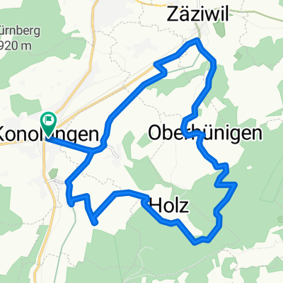
- 42.4 km
- Distance
- 2,136 m
- Ascent
- 1,776 m
- Descent
- ---
- Avg. speed
- 1,124 m
- Max. altitude

Route photos

Continue with Bikemap
Use, edit, or download this cycling route
You would like to ride Tannzäpfu-Bromi und Siehetrail or customize it for your own trip? Here is what you can do with this Bikemap route:
Free features
- Save this route as favorite or in collections
- Copy & plan your own version of this route
- Sync your route with Garmin or Wahoo
Premium features
Free trial for 3 days, or one-time payment. More about Bikemap Premium.
- Navigate this route on iOS & Android
- Export a GPX / KML file of this route
- Create your custom printout (try it for free)
- Download this route for offline navigation
Discover more Premium features.
Get Bikemap PremiumFrom our community
Other popular routes starting in Konolfingen
 Flurweg, Konolfingen nach Inselistrasse, Konolfingen
- Distance
- 14.1 km
- Ascent
- 296 m
- Descent
- 304 m
- Location
- Konolfingen, Canton of Bern, Switzerland
 Konolfingen - Köniz - Thörishaus - Flamatt - Fribourg
- Distance
- 54.8 km
- Ascent
- 581 m
- Descent
- 593 m
- Location
- Konolfingen, Canton of Bern, Switzerland
 Konolfingen-Schwarzenburg
- Distance
- 51 km
- Ascent
- 559 m
- Descent
- 429 m
- Location
- Konolfingen, Canton of Bern, Switzerland
 Chuderhüsi_Blasenwald_Ballenbüehl
- Distance
- 38.7 km
- Ascent
- 1,220 m
- Descent
- 1,220 m
- Location
- Konolfingen, Canton of Bern, Switzerland
 Aufnahme vom 09.05.2016, 14:30
- Distance
- 24.3 km
- Ascent
- 618 m
- Descent
- 618 m
- Location
- Konolfingen, Canton of Bern, Switzerland
 Kappeler
- Distance
- 73.9 km
- Ascent
- 597 m
- Descent
- 597 m
- Location
- Konolfingen, Canton of Bern, Switzerland
 montage nestle 2008
- Distance
- 17.2 km
- Ascent
- 498 m
- Descent
- 500 m
- Location
- Konolfingen, Canton of Bern, Switzerland
 Konolfingen-Würzbrunnen-Schallenberg-Konolfingen
- Distance
- 65.1 km
- Ascent
- 1,238 m
- Descent
- 1,289 m
- Location
- Konolfingen, Canton of Bern, Switzerland
Open it in the app