

Orle 2011
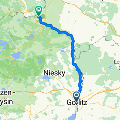
A cycling route starting in Zgorzelec, Lower Silesian Voivodeship, Poland.
Overview
About this route
- -:--
- Duration
- 123.5 km
- Distance
- 1,100 m
- Ascent
- 1,100 m
- Descent
- ---
- Avg. speed
- ---
- Max. altitude
Route quality
Waytypes & surfaces along the route
Waytypes
Track
37.1 km
(30 %)
Road
19.8 km
(16 %)
Surfaces
Paved
77.8 km
(63 %)
Unpaved
18.5 km
(15 %)
Asphalt
74.1 km
(60 %)
Gravel
9.9 km
(8 %)
Route highlights
Points of interest along the route
Point of interest after 55.3 km
Stacja Górska Orle
Continue with Bikemap
Use, edit, or download this cycling route
You would like to ride Orle 2011 or customize it for your own trip? Here is what you can do with this Bikemap route:
Free features
- Save this route as favorite or in collections
- Copy & plan your own version of this route
- Split it into stages to create a multi-day tour
- Sync your route with Garmin or Wahoo
Premium features
Free trial for 3 days, or one-time payment. More about Bikemap Premium.
- Navigate this route on iOS & Android
- Export a GPX / KML file of this route
- Create your custom printout (try it for free)
- Download this route for offline navigation
Discover more Premium features.
Get Bikemap PremiumFrom our community
Other popular routes starting in Zgorzelec
 Wypad do Mużaka Dzien 1
- Distance
- 47.7 km
- Ascent
- 745 m
- Descent
- 845 m
- Location
- Zgorzelec, Lower Silesian Voivodeship, Poland
 Nysa-Odra Zgorzelec-Świnoujście
- Distance
- 493.9 km
- Ascent
- 170 m
- Descent
- 377 m
- Location
- Zgorzelec, Lower Silesian Voivodeship, Poland
 Um den Czorneboh
- Distance
- 117.9 km
- Ascent
- 735 m
- Descent
- 735 m
- Location
- Zgorzelec, Lower Silesian Voivodeship, Poland
 Zgorzelec do Łęknica
- Distance
- 79.2 km
- Ascent
- 444 m
- Descent
- 530 m
- Location
- Zgorzelec, Lower Silesian Voivodeship, Poland
 Sybiraków 15, Zgorzelec do Łużycka 33, Zgorzelec
- Distance
- 20.6 km
- Ascent
- 16 m
- Descent
- 33 m
- Location
- Zgorzelec, Lower Silesian Voivodeship, Poland
 Pieńsk i przez Niemcy
- Distance
- 30.7 km
- Ascent
- 123 m
- Descent
- 123 m
- Location
- Zgorzelec, Lower Silesian Voivodeship, Poland
 D 02 70km Görli-Muskau
- Distance
- 69.5 km
- Ascent
- 411 m
- Descent
- 482 m
- Location
- Zgorzelec, Lower Silesian Voivodeship, Poland
 Route to Ostritz Sankt Marienthal
- Distance
- 28.2 km
- Ascent
- 304 m
- Descent
- 250 m
- Location
- Zgorzelec, Lower Silesian Voivodeship, Poland
Open it in the app