Starych Drzew
- 50.8 km
- 82 m
- 81 m
- Gmina Piątek, Łódź Voivodeship, Poland
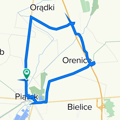
A cycling route starting in Gmina Piątek, Łódź Voivodeship, Poland.
Overview
The route is marked in yellow (Battle of Bzura trail). Navigation is sometimes difficult due to lack of signage.
created this 14 years ago
Route quality
Quiet road
29.6 km
(67 %)
Track
8.4 km
(19 %)
Paved
22.5 km
(51 %)
Unpaved
4.4 km
(10 %)
Asphalt
22.5 km
(51 %)
Sand
2.6 km
(6 %)
Route highlights
-zmodyfikowany 2014\"")
Dwór w Goślub - Obecnie filia stadniny koni w Walewicach
-zmodyfikowany 2014\"")
Punkt widokowy - stare grodzisko + mostek Aktualizacja 2014r. - mostku już nie ma !!!
Continue with Bikemap
You would like to ride Tour de Piątek (żółty)-zmodyfikowany 2014 or customize it for your own trip? Here is what you can do with this Bikemap route:
Free trial for 3 days, or one-time payment. More about Bikemap Premium.
Discover more Premium features.
Get Bikemap PremiumFrom our community
Open it in the app