
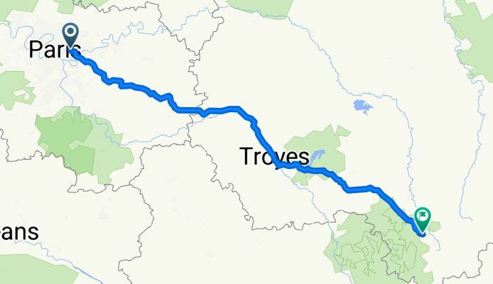
Montreuil - Beauchemin 285km
A cycling route starting in Fontenay-sous-Bois, Île-de-France Region, France.
Overview
About this route
- -:--
- Duration
- 284.5 km
- Distance
- 797 m
- Ascent
- 497 m
- Descent
- ---
- Avg. speed
- 412 m
- Max. altitude

Route quality
Waytypes & surfaces along the route
Waytypes
Road
142.3 km
(50 %)
Path
51.2 km
(18 %)
Surfaces
Paved
167.9 km
(59 %)
Unpaved
2.8 km
(1 %)
Asphalt
165 km
(58 %)
Concrete
2.8 km
(1 %)
Continue with Bikemap
Use, edit, or download this cycling route
You would like to ride Montreuil - Beauchemin 285km or customize it for your own trip? Here is what you can do with this Bikemap route:
Free features
- Save this route as favorite or in collections
- Copy & plan your own version of this route
- Split it into stages to create a multi-day tour
- Sync your route with Garmin or Wahoo
Premium features
Free trial for 3 days, or one-time payment. More about Bikemap Premium.
- Navigate this route on iOS & Android
- Export a GPX / KML file of this route
- Create your custom printout (try it for free)
- Download this route for offline navigation
Discover more Premium features.
Get Bikemap PremiumFrom our community
Other popular routes starting in Fontenay-sous-Bois
 Paris 2 Epernay
- Distance
- 130.5 km
- Ascent
- 523 m
- Descent
- 512 m
- Location
- Fontenay-sous-Bois, Île-de-France Region, France
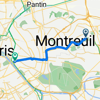 Boulevard Théophile Sueur, Montreuil à Place Louis Armand, Paris
- Distance
- 10.1 km
- Ascent
- 39 m
- Descent
- 109 m
- Location
- Fontenay-sous-Bois, Île-de-France Region, France
 21 Rue des Mocards, Fontenay-sous-Bois à 1 Rue de la République, Charenton-le-Pont
- Distance
- 6.3 km
- Ascent
- 98 m
- Descent
- 119 m
- Location
- Fontenay-sous-Bois, Île-de-France Region, France
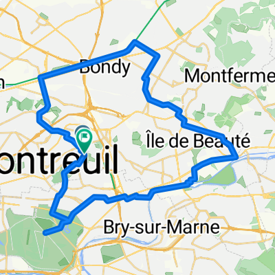
 CAP_velo
- Distance
- 147.7 km
- Ascent
- 602 m
- Descent
- 668 m
- Location
- Fontenay-sous-Bois, Île-de-France Region, France
 Fontenay _ Villenoy
- Distance
- 44.5 km
- Ascent
- 74 m
- Descent
- 127 m
- Location
- Fontenay-sous-Bois, Île-de-France Region, France
 home - Gare de Lyon
- Distance
- 9.1 km
- Ascent
- 33 m
- Descent
- 104 m
- Location
- Fontenay-sous-Bois, Île-de-France Region, France
 De Boulevard Théophile Sueur à Boulevard Théophile Sueur
- Distance
- 37.4 km
- Ascent
- 204 m
- Descent
- 204 m
- Location
- Fontenay-sous-Bois, Île-de-France Region, France
 48 Rue Roger Salengro, Fontenay-sous-Bois à 6 Avenue Aubert, Vincennes
- Distance
- 4.5 km
- Ascent
- 53 m
- Descent
- 62 m
- Location
- Fontenay-sous-Bois, Île-de-France Region, France
Open it in the app