
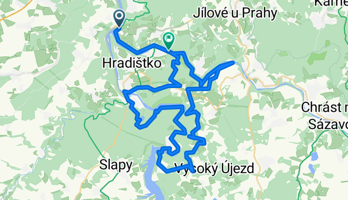
Davle - Kamenný Přívoz - Slapská přehrada
A cycling route starting in Davle, Central Bohemia, Czechia.
Overview
About this route
- -:--
- Duration
- 45.3 km
- Distance
- 896 m
- Ascent
- 885 m
- Descent
- ---
- Avg. speed
- ---
- Max. altitude

Continue with Bikemap
Use, edit, or download this cycling route
You would like to ride Davle - Kamenný Přívoz - Slapská přehrada or customize it for your own trip? Here is what you can do with this Bikemap route:
Free features
- Save this route as favorite or in collections
- Copy & plan your own version of this route
- Sync your route with Garmin or Wahoo
Premium features
Free trial for 3 days, or one-time payment. More about Bikemap Premium.
- Navigate this route on iOS & Android
- Export a GPX / KML file of this route
- Create your custom printout (try it for free)
- Download this route for offline navigation
Discover more Premium features.
Get Bikemap PremiumFrom our community
Other popular routes starting in Davle
 C01x Davle-Milin
- Distance
- 55.5 km
- Ascent
- 645 m
- Descent
- 293 m
- Location
- Davle, Central Bohemia, Czechia
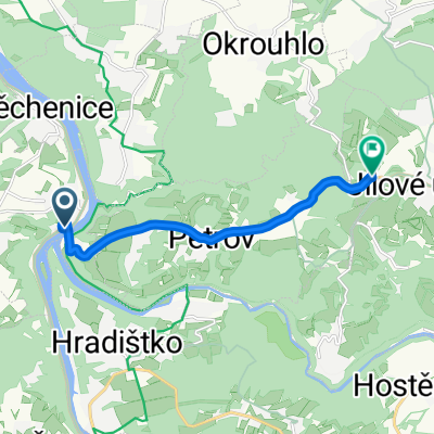 KPO Tréninková tour Davle - Jílové
- Distance
- 7.2 km
- Ascent
- 263 m
- Descent
- 40 m
- Location
- Davle, Central Bohemia, Czechia
 Davle>Pyšely, Posázaví po červené turistické
- Distance
- 40.3 km
- Ascent
- 671 m
- Descent
- 584 m
- Location
- Davle, Central Bohemia, Czechia
 2016_CZtyp006
- Distance
- 161.4 km
- Ascent
- 966 m
- Descent
- 798 m
- Location
- Davle, Central Bohemia, Czechia
 závod Davle1
- Distance
- 19.4 km
- Ascent
- 460 m
- Descent
- 460 m
- Location
- Davle, Central Bohemia, Czechia
 Davle - Karlstein - Praha
- Distance
- 56.6 km
- Ascent
- 541 m
- Descent
- 549 m
- Location
- Davle, Central Bohemia, Czechia
 C01 Davle-Kamyk
- Distance
- 54.1 km
- Ascent
- 711 m
- Descent
- 594 m
- Location
- Davle, Central Bohemia, Czechia
 sazava radweg und burg pernstejn
- Distance
- 307.6 km
- Ascent
- 1,707 m
- Descent
- 1,662 m
- Location
- Davle, Central Bohemia, Czechia
Open it in the app