

Mur 14: Stadl an der Mur - Hintermuhr, 50,8km, 362hm
A cycling route starting in Stadl an der Mur, Styria, Austria.
Overview
About this route
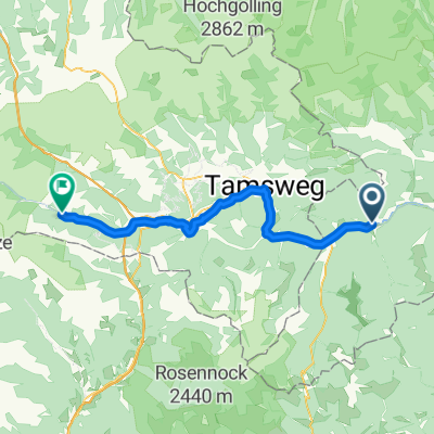
Steindorf - Predlitz - Kendlbruck - Hintering - Ramingstein - Tamsweg - Judendorf - Neggerndorf - Unternberg - Illmitzen - Oberbayrdorf - St. Michael in Lungau - Schellgaden - Muhr - Hintermuhr Gasthof zur Post,
- -:--
- Duration
- 50.8 km
- Distance
- 362 m
- Ascent
- 99 m
- Descent
- ---
- Avg. speed
- 1,147 m
- Max. altitude

Route quality
Waytypes & surfaces along the route
Waytypes
Quiet road
22.9 km
(45 %)
Cycleway
11.7 km
(23 %)
Surfaces
Paved
32.5 km
(64 %)
Unpaved
1.5 km
(3 %)
Paved (undefined)
22.4 km
(44 %)
Asphalt
7.1 km
(14 %)
Route highlights
Points of interest along the route
Point of interest after 30.2 km
Badestelle?
Point of interest after 34.8 km
Badestelle Murinsel?
Continue with Bikemap
Use, edit, or download this cycling route
You would like to ride Mur 14: Stadl an der Mur - Hintermuhr, 50,8km, 362hm or customize it for your own trip? Here is what you can do with this Bikemap route:
Free features
- Save this route as favorite or in collections
- Copy & plan your own version of this route
- Sync your route with Garmin or Wahoo
Premium features
Free trial for 3 days, or one-time payment. More about Bikemap Premium.
- Navigate this route on iOS & Android
- Export a GPX / KML file of this route
- Create your custom printout (try it for free)
- Download this route for offline navigation
Discover more Premium features.
Get Bikemap PremiumFrom our community
Other popular routes starting in Stadl an der Mur
 Vorschlag Tag 7
- Distance
- 129.2 km
- Ascent
- 1,436 m
- Descent
- 1,856 m
- Location
- Stadl an der Mur, Styria, Austria
 Oesterreich 2016 - 4/7
- Distance
- 133.2 km
- Ascent
- 4,072 m
- Descent
- 4,139 m
- Location
- Stadl an der Mur, Styria, Austria
 Moto 08.06.2014
- Distance
- 264.3 km
- Ascent
- 4,288 m
- Descent
- 4,235 m
- Location
- Stadl an der Mur, Styria, Austria
 Route nach Villach
- Distance
- 84.9 km
- Ascent
- 1,755 m
- Descent
- 2,658 m
- Location
- Stadl an der Mur, Styria, Austria
 Drau Mur Runde 18
- Distance
- 33.2 km
- Ascent
- 236 m
- Descent
- 79 m
- Location
- Stadl an der Mur, Styria, Austria
 Stadl an der Mur - Flattnitz - Stadl an der Mur 40km
- Distance
- 43.9 km
- Ascent
- 948 m
- Descent
- 947 m
- Location
- Stadl an der Mur, Styria, Austria
 Stadl an der Mur, Stadl-Predlitz nach Vordermuhr, Muhr
- Distance
- 51.4 km
- Ascent
- 585 m
- Descent
- 351 m
- Location
- Stadl an der Mur, Styria, Austria
 Mur 14: Stadl an der Mur - Hintermuhr, 50,8km, 362hm
- Distance
- 50.8 km
- Ascent
- 362 m
- Descent
- 99 m
- Location
- Stadl an der Mur, Styria, Austria
Open it in the app