Lechicka do Jana Pawła II 2A
- 7.9 km
- 77 m
- 65 m
- Koszalin, West Pomeranian Voivodeship, Poland
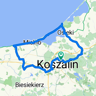
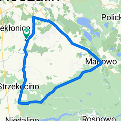
A cycling route starting in Koszalin, West Pomeranian Voivodeship, Poland.
Overview
The route was mapped from memory. There is not 100% correspondence to GPS coordinates. The first part (Koszalin – Wyszebórz – Wyszewo – Mostowo – Kamienne Kręgi Nature Reserve up to the junction with road 168 near the village of Karsina) follows the green trail (part of Bike the Baltic). Then, a detour to Lake Morskie Oko (close to road 168). A few kilometers on the road to the Leśników Park near Rekowo, where we turn onto the blue trail toward Wyszebórz. We leave the trail toward Kościernica and return to Koszalin by road. Just one more small climb to Chełmska Hill and then home.
created this 14 years ago
Continue with Bikemap
You would like to ride Pętelka Koszalińska or customize it for your own trip? Here is what you can do with this Bikemap route:
Free trial for 3 days, or one-time payment. More about Bikemap Premium.
Discover more Premium features.
Get Bikemap PremiumFrom our community
Open it in the app