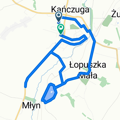
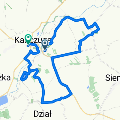
Trasa od bajeczna, kańczuga do bajeczna, kańczuga
A cycling route starting in Kańczuga, Subcarpathian Voivodeship, Poland.
Overview
About this route
- -:--
- Duration
- 100.1 km
- Distance
- 563 m
- Ascent
- 563 m
- Descent
- ---
- Avg. speed
- 434 m
- Max. altitude
Route quality
Waytypes & surfaces along the route
Waytypes
Road
56.1 km
(56 %)
Quiet road
8 km
(8 %)
Surfaces
Paved
85.1 km
(85 %)
Asphalt
85.1 km
(85 %)
Undefined
15 km
(15 %)
Continue with Bikemap
Use, edit, or download this cycling route
You would like to ride Trasa od bajeczna, kańczuga do bajeczna, kańczuga or customize it for your own trip? Here is what you can do with this Bikemap route:
Free features
- Save this route as favorite or in collections
- Copy & plan your own version of this route
- Split it into stages to create a multi-day tour
- Sync your route with Garmin or Wahoo
Premium features
Free trial for 3 days, or one-time payment. More about Bikemap Premium.
- Navigate this route on iOS & Android
- Export a GPX / KML file of this route
- Create your custom printout (try it for free)
- Download this route for offline navigation
Discover more Premium features.
Get Bikemap PremiumFrom our community
Other popular routes starting in Kańczuga
- Zielona do Węgierska 39A
- Distance
- 19 km
- Ascent
- 163 m
- Descent
- 204 m
- Location
- Kańczuga, Subcarpathian Voivodeship, Poland
- 75 (19/16) Rożniatów-Jarosław-WÓLKA PEŁKIŃSKA-Tryńcza-Przeworsk
- Distance
- 74.2 km
- Ascent
- 271 m
- Descent
- 271 m
- Location
- Kańczuga, Subcarpathian Voivodeship, Poland
- #2 GSR "Junior"
- Distance
- 17.3 km
- Ascent
- 145 m
- Descent
- 137 m
- Location
- Kańczuga, Subcarpathian Voivodeship, Poland
- Szkolna do Wolności
- Distance
- 21 km
- Ascent
- 225 m
- Descent
- 276 m
- Location
- Kańczuga, Subcarpathian Voivodeship, Poland
- 65 (64/16) Przeworsk-Tryńcza-Pełkinie-Krzeczowice
- Distance
- 64.6 km
- Ascent
- 134 m
- Descent
- 134 m
- Location
- Kańczuga, Subcarpathian Voivodeship, Poland
- 130 (55/16) Rudołowice-Radymno-Wiązownica-Radawa-Sieniawa-Przeworsk
- Distance
- 133.9 km
- Ascent
- 258 m
- Descent
- 260 m
- Location
- Kańczuga, Subcarpathian Voivodeship, Poland
- 68 km Gminny Szlak Rowerowy "K-ga Max" (Kańczucka pętla)
- Distance
- 68.2 km
- Ascent
- 710 m
- Descent
- 715 m
- Location
- Kańczuga, Subcarpathian Voivodeship, Poland
- # 3 GSR "EDU 9"
- Distance
- 43.2 km
- Ascent
- 380 m
- Descent
- 388 m
- Location
- Kańczuga, Subcarpathian Voivodeship, Poland
Open it in the app