

Haslaurunde 3
A cycling route starting in Frankenmarkt, Upper Austria, Austria.
Overview
About this route
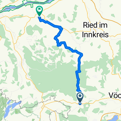
B1 Nähe Schwaigern, Rudlberg, Hüttenedt, Jagdhub, Haslau, Harpoint, Vöcklabach folgend nach Hauberg, Mondsee, Schlößl, Haidermühle, Westufer Irrsee, Harberg, Oberhofen, Stockham, Schwandt, Hochfeld, Hüttenedt, Rudlberg, B1 Nähe Schwaigern
- -:--
- Duration
- 49.2 km
- Distance
- 769 m
- Ascent
- 768 m
- Descent
- ---
- Avg. speed
- 802 m
- Max. altitude

Route quality
Waytypes & surfaces along the route
Waytypes
Quiet road
28 km
(57 %)
Road
19.7 km
(40 %)
Surfaces
Paved
14.8 km
(30 %)
Asphalt
14.8 km
(30 %)
Undefined
34.4 km
(70 %)
Continue with Bikemap
Use, edit, or download this cycling route
You would like to ride Haslaurunde 3 or customize it for your own trip? Here is what you can do with this Bikemap route:
Free features
- Save this route as favorite or in collections
- Copy & plan your own version of this route
- Sync your route with Garmin or Wahoo
Premium features
Free trial for 3 days, or one-time payment. More about Bikemap Premium.
- Navigate this route on iOS & Android
- Export a GPX / KML file of this route
- Create your custom printout (try it for free)
- Download this route for offline navigation
Discover more Premium features.
Get Bikemap PremiumFrom our community
Other popular routes starting in Frankenmarkt
 Schnelle Ausfahrt durch Frankenmarkt
- Distance
- 4.3 km
- Ascent
- 45 m
- Descent
- 43 m
- Location
- Frankenmarkt, Upper Austria, Austria
 Innviertel 2019 - 5
- Distance
- 46.7 km
- Ascent
- 226 m
- Descent
- 402 m
- Location
- Frankenmarkt, Upper Austria, Austria
 Td98_4. den Frankenmark - Hochtor
- Distance
- 161.7 km
- Ascent
- 2,354 m
- Descent
- 511 m
- Location
- Frankenmarkt, Upper Austria, Austria
 Haslaurunde 2
- Distance
- 66.6 km
- Ascent
- 531 m
- Descent
- 531 m
- Location
- Frankenmarkt, Upper Austria, Austria
 Teil 1 cahllenge privat
- Distance
- 140.1 km
- Ascent
- 724 m
- Descent
- 978 m
- Location
- Frankenmarkt, Upper Austria, Austria
 Haslaurunde 1
- Distance
- 61 km
- Ascent
- 886 m
- Descent
- 886 m
- Location
- Frankenmarkt, Upper Austria, Austria
 Innviertel 2019 - 5a
- Distance
- 49 km
- Ascent
- 362 m
- Descent
- 539 m
- Location
- Frankenmarkt, Upper Austria, Austria
 Haslaurunde 3
- Distance
- 49.2 km
- Ascent
- 769 m
- Descent
- 768 m
- Location
- Frankenmarkt, Upper Austria, Austria
Open it in the app