- 83.7 km
- 624 m
- 575 m
- Pegnitz, Bavaria, Germany
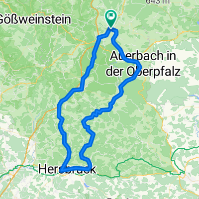
Rundfahrt Pegnitz (Neudorf) - Plech - Neuhaus - Auerbach - Pegnitz (Neudorf)
A cycling route starting in Pegnitz, Bavaria, Germany.
Overview
About this route
The tour to Plech gently descends and is enjoyable to ride (a lightly trafficked federal road through the Veldenstein Forest). After Plech, there is a longer climb up to just before Höfen. Then it continues relatively flat again to Neuhaus/Rothenbruck. In Neuhaus, you can stop for a good break (e.g., at the castle inn or Kommune, a rustic traditional Bavarian single-room establishment with local snacks and home-brewed strong beer). In Rothenbruck, turn left over a bridge and then a longer uphill stretch to Bärnhof. After the curve, just beyond the town sign, turn left for a shorter, steep climb. From there, head left downhill to Finstermühle, simply following the road, and after the village, climb a bigger hill, then turn right towards Krottensee. In Krottensee, turn left following the road through the town. At the next junction after the town sign, take road 2162 to Auerbach and from there left onto federal road 85 towards Pegnitz.
- -:--
- Duration
- 50.7 km
- Distance
- 414 m
- Ascent
- 414 m
- Descent
- ---
- Avg. speed
- ---
- Max. altitude
created this 14 years ago
Route quality
Waytypes & surfaces along the route
Waytypes
Road
11.2 km
(22 %)
Quiet road
4.1 km
(8 %)
Surfaces
Paved
22.8 km
(45 %)
Unpaved
2.5 km
(5 %)
Asphalt
22.3 km
(44 %)
Gravel
2 km
(4 %)
Continue with Bikemap
Use, edit, or download this cycling route
You would like to ride Rundfahrt Pegnitz (Neudorf) - Plech - Neuhaus - Auerbach - Pegnitz (Neudorf) or customize it for your own trip? Here is what you can do with this Bikemap route:
Free features
- Save this route as favorite or in collections
- Copy & plan your own version of this route
- Sync your route with Garmin or Wahoo
Premium features
Free trial for 3 days, or one-time payment. More about Bikemap Premium.
- Navigate this route on iOS & Android
- Export a GPX / KML file of this route
- Create your custom printout (try it for free)
- Download this route for offline navigation
Discover more Premium features.
Get Bikemap PremiumFrom our community
Other popular routes starting in Pegnitz
- Von Pegnitz durch den Veldensteiner Forst
- Physio Pegnitz
- 2.2 km
- 22 m
- 23 m
- Pegnitz, Bavaria, Germany
- Pegnitz - Wander
- 4 km
- 117 m
- 115 m
- Pegnitz, Bavaria, Germany
- _MainRadweg „Roter Main“_
- 486.7 km
- 3,097 m
- 3,382 m
- Pegnitz, Bavaria, Germany
- _MainRadweg „Roter Main“_
- 486.7 km
- 3,097 m
- 3,382 m
- Pegnitz, Bavaria, Germany
- Pegnitz - Kleiner Kulm - Pegnitz
- 14.1 km
- 396 m
- 394 m
- Pegnitz, Bavaria, Germany
- Runde nach Königsstein
- 56.6 km
- 521 m
- 518 m
- Pegnitz, Bavaria, Germany
- FS5 Veldenstein Forst
- 106.9 km
- 2,076 m
- 2,079 m
- Pegnitz, Bavaria, Germany
Open it in the app


