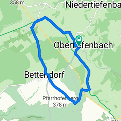
Dörscheid 52,1 - 670
A cycling route starting in Obertiefenbach, Rhineland-Palatinate, Germany.
Overview
About this route
- -:--
- Duration
- 52.1 km
- Distance
- 518 m
- Ascent
- 518 m
- Descent
- ---
- Avg. speed
- 416 m
- Max. altitude
Route quality
Waytypes & surfaces along the route
Waytypes
Track
22.1 km
(42 %)
Quiet road
10.8 km
(21 %)
Surfaces
Paved
33.1 km
(63 %)
Unpaved
9.1 km
(17 %)
Asphalt
24.5 km
(47 %)
Paved (undefined)
8.6 km
(17 %)
Continue with Bikemap
Use, edit, or download this cycling route
You would like to ride Dörscheid 52,1 - 670 or customize it for your own trip? Here is what you can do with this Bikemap route:
Free features
- Save this route as favorite or in collections
- Copy & plan your own version of this route
- Sync your route with Garmin or Wahoo
Premium features
Free trial for 3 days, or one-time payment. More about Bikemap Premium.
- Navigate this route on iOS & Android
- Export a GPX / KML file of this route
- Create your custom printout (try it for free)
- Download this route for offline navigation
Discover more Premium features.
Get Bikemap PremiumFrom our community
Other popular routes starting in Obertiefenbach
- Testrunde
- Distance
- 12.6 km
- Ascent
- 326 m
- Descent
- 326 m
- Location
- Obertiefenbach, Rhineland-Palatinate, Germany
- nach Bogel über Mielen
- Distance
- 9.8 km
- Ascent
- 194 m
- Descent
- 175 m
- Location
- Obertiefenbach, Rhineland-Palatinate, Germany
- Tom Klee Geisig
- Distance
- 9.8 km
- Ascent
- 95 m
- Descent
- 223 m
- Location
- Obertiefenbach, Rhineland-Palatinate, Germany
- Römerkastell Rettert Niedertiefenbach
- Distance
- 26.6 km
- Ascent
- 554 m
- Descent
- 549 m
- Location
- Obertiefenbach, Rhineland-Palatinate, Germany
- Dörsbachtal Runde
- Distance
- 42.3 km
- Ascent
- 601 m
- Descent
- 687 m
- Location
- Obertiefenbach, Rhineland-Palatinate, Germany
- Römerkastell Rettert Niedertiefenbach
- Distance
- 26.7 km
- Ascent
- 485 m
- Descent
- 478 m
- Location
- Obertiefenbach, Rhineland-Palatinate, Germany
- Obtiba Gemmer St Gohau Miehl Obtiba
- Distance
- 44.1 km
- Ascent
- 791 m
- Descent
- 775 m
- Location
- Obertiefenbach, Rhineland-Palatinate, Germany
- Heimatrunde
- Distance
- 40.6 km
- Ascent
- 728 m
- Descent
- 734 m
- Location
- Obertiefenbach, Rhineland-Palatinate, Germany
Open it in the app