

D10BeneRibnicaArko21
A cycling route starting in Benedikt, Benedikt, Slovenia.
Overview
About this route
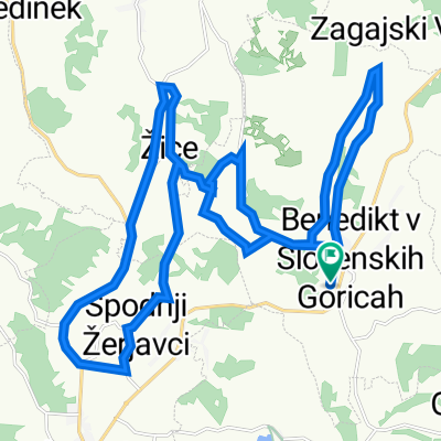
Trstenik-Ihova-Zgornja Bačkova-Rožengrunt-Lokavec Sveta Ana-near Trate (Mura)-Zgornja velka-(near Šentilj in the Slovenske Gorice-Štrihovec-we cross the motorway and then along the motorway-Spodnje Dobrenje (before the settlement we cross the motorway again)-Doljna Počehova-(we cross the motorway)-Maribor-cross the Drava and along the Drava-Laznica-Bistrica ob Dravi-Ruše-Fala (Castle)-we move away from the Drava-Činžat-Puščava-(by the water of Sepnica and then by the water of Presih, then by the water of Velka)-Janževski vrh-Ribnica na Pohorju (86 km, 920 m up, 479 down)
- -:--
- Duration
- 86.1 km
- Distance
- 920 m
- Ascent
- 479 m
- Descent
- ---
- Avg. speed
- 716 m
- Max. altitude

Route quality
Waytypes & surfaces along the route
Waytypes
Quiet road
45.6 km
(53 %)
Road
26.7 km
(31 %)
Surfaces
Paved
61.1 km
(71 %)
Unpaved
6 km
(7 %)
Asphalt
60.3 km
(70 %)
Gravel
4.3 km
(5 %)
Continue with Bikemap
Use, edit, or download this cycling route
You would like to ride D10BeneRibnicaArko21 or customize it for your own trip? Here is what you can do with this Bikemap route:
Free features
- Save this route as favorite or in collections
- Copy & plan your own version of this route
- Split it into stages to create a multi-day tour
- Sync your route with Garmin or Wahoo
Premium features
Free trial for 3 days, or one-time payment. More about Bikemap Premium.
- Navigate this route on iOS & Android
- Export a GPX / KML file of this route
- Create your custom printout (try it for free)
- Download this route for offline navigation
Discover more Premium features.
Get Bikemap PremiumFrom our community
Other popular routes starting in Benedikt
 10 dan benedik ribnica
- Distance
- 85.8 km
- Ascent
- 1,934 m
- Descent
- 1,489 m
- Location
- Benedikt, Benedikt, Slovenia
 Benedikt -Negova - Benedikt
- Distance
- 18.3 km
- Ascent
- 217 m
- Descent
- 219 m
- Location
- Benedikt, Benedikt, Slovenia
 Vinogradniška pot 17 to Vinogradniška pot 17
- Distance
- 29.4 km
- Ascent
- 322 m
- Descent
- 323 m
- Location
- Benedikt, Benedikt, Slovenia
 Vinogradniška pot 17 to Vinogradniška pot 17
- Distance
- 36.9 km
- Ascent
- 491 m
- Descent
- 541 m
- Location
- Benedikt, Benedikt, Slovenia
 D10BenediktRibnicaNaPohorju
- Distance
- 87.9 km
- Ascent
- 1,742 m
- Descent
- 1,301 m
- Location
- Benedikt, Benedikt, Slovenia
 D10BeneRibnicaArko21
- Distance
- 86.1 km
- Ascent
- 920 m
- Descent
- 479 m
- Location
- Benedikt, Benedikt, Slovenia
 Vinogradniška pot 17 to Vinogradniška pot 17
- Distance
- 41.4 km
- Ascent
- 422 m
- Descent
- 473 m
- Location
- Benedikt, Benedikt, Slovenia
 Kolesarska pot naravnih znamenitosti po Ekomuzeju
- Distance
- 28.2 km
- Ascent
- 435 m
- Descent
- 371 m
- Location
- Benedikt, Benedikt, Slovenia
Open it in the app