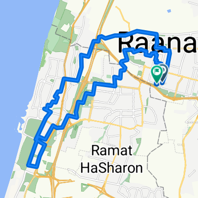
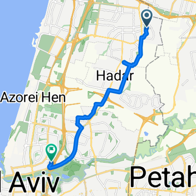
Test to see if popular reoute on bikemap is road
A cycling route starting in Raanana, Central District, Israel.
Overview
About this route
- -:--
- Duration
- 15.4 km
- Distance
- 94 m
- Ascent
- 97 m
- Descent
- ---
- Avg. speed
- 68 m
- Max. altitude
Route quality
Waytypes & surfaces along the route
Waytypes
- Quiet road - 6.5 km - (42 %) 
- Road - 3.7 km - (24 %) 
Surfaces
Paved
1.1 km
(7 %)
Unpaved
0.3 km
(2 %)
- Asphalt - 1.1 km - (7 %) 
- Gravel - 0.3 km - (2 %) 
- Undefined - 14.1 km - (91 %) 
Continue with Bikemap
Use, edit, or download this cycling route
You would like to ride Test to see if popular reoute on bikemap is road or customize it for your own trip? Here is what you can do with this Bikemap route:
Free features
- Save this route as favorite or in collections
- Copy & plan your own version of this route
- Sync your route with Garmin or Wahoo
Premium features
Free trial for 3 days, or one-time payment. More about Bikemap Premium.
- Navigate this route on iOS & Android
- Export a GPX / KML file of this route
- Create your custom printout (try it for free)
- Download this route for offline navigation
Discover more Premium features.
Get Bikemap PremiumFrom our community
Other popular routes starting in Raanana
 ืืืช ืืขืืืื ืืื ืงืฆืจ ืืืช ืืขืืืื ืืื ืงืฆืจ- Distance
- 12.2 km
- Ascent
- 74 m
- Descent
- 120 m
- Location
- Raanana, Central District, Israel
 
 ืฉืืฉื ืืืื ืฉืืฉื ืืืื- Distance
- 24.3 km
- Ascent
- 131 m
- Descent
- 132 m
- Location
- Raanana, Central District, Israel
 
 ืืคืจืืื 2 ืืจืืฉืืื ืืืื ืืคืจืืื 2 ืืจืืฉืืื ืืืื- Distance
- 29 km
- Ascent
- 151 m
- Descent
- 150 m
- Location
- Raanana, Central District, Israel
 
 Ha'sharon Street 20, Ra'anana to Herzliya Ha'sharon Street 20, Ra'anana to Herzliya- Distance
- 9.2 km
- Ascent
- 59 m
- Descent
- 95 m
- Location
- Raanana, Central District, Israel
 
 Park Hayarkon por Hod Hasharon Park Hayarkon por Hod Hasharon- Distance
- 48.1 km
- Ascent
- 20 m
- Descent
- 25 m
- Location
- Raanana, Central District, Israel
 
 ืืืกืืื ืฉื ืืืจื ืืืื ืฉืืฉื ืฆืจืื ืืืืืช ืืืืคื ืืืื ืืืืืจ ืืืกืืื ืฉื ืืืจื ืืืื ืฉืืฉื ืฆืจืื ืืืืืช ืืืืคื ืืืื ืืืืืจ- Distance
- 1.9 km
- Ascent
- 34 m
- Descent
- 26 m
- Location
- Raanana, Central District, Israel
 
 ัะฐะฐะฝะฐะฝะฐ ะฟะพะปั ะฟะพะฑะตัะตะถัะต ะฑะฐะนะบ ัะฐะฐะฝะฐะฝะฐ ะฟะพะปั ะฟะพะฑะตัะตะถัะต ะฑะฐะนะบ- Distance
- 39.9 km
- Ascent
- 284 m
- Descent
- 291 m
- Location
- Raanana, Central District, Israel
 
 Maccabi Street 50, Ra'anana to Taasi'on Ha-sharon Maccabi Street 50, Ra'anana to Taasi'on Ha-sharon- Distance
- 14.4 km
- Ascent
- 47 m
- Descent
- 82 m
- Location
- Raanana, Central District, Israel
 
Open it in the app

