

Eroica Germania 2021 - short route
A cycling route starting in Eltville, Hesse, Germany.
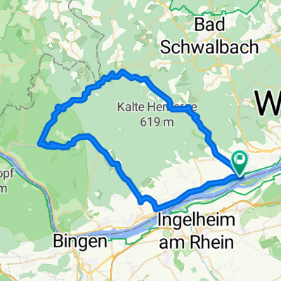
Overview
About this route
- -:--
- Duration
- 45.5 km
- Distance
- 682 m
- Ascent
- 676 m
- Descent
- ---
- Avg. speed
- 252 m
- Max. altitude

Route quality
Waytypes & surfaces along the route
Waytypes
Track
24.1 km
(53 %)
Quiet road
7.3 km
(16 %)
Surfaces
Paved
38.7 km
(85 %)
Unpaved
4.6 km
(10 %)
Asphalt
35 km
(77 %)
Concrete
3.2 km
(7 %)
Continue with Bikemap
Use, edit, or download this cycling route
You would like to ride Eroica Germania 2021 - short route or customize it for your own trip? Here is what you can do with this Bikemap route:
Free features
- Save this route as favorite or in collections
- Copy & plan your own version of this route
- Sync your route with Garmin or Wahoo
Premium features
Free trial for 3 days, or one-time payment. More about Bikemap Premium.
- Navigate this route on iOS & Android
- Export a GPX / KML file of this route
- Create your custom printout (try it for free)
- Download this route for offline navigation
Discover more Premium features.
Get Bikemap PremiumFrom our community
Other popular routes starting in Eltville
 Eltville -> Frauenstein -> Hohe Wurzel -> Rauenthal
- Distance
- 35.8 km
- Ascent
- 670 m
- Descent
- 580 m
- Location
- Eltville, Hesse, Germany
 Easy ride in Eltville
- Distance
- 41.7 km
- Ascent
- 238 m
- Descent
- 229 m
- Location
- Eltville, Hesse, Germany
 Kalte Herberge Runde 1
- Distance
- 24.1 km
- Ascent
- 569 m
- Descent
- 568 m
- Location
- Eltville, Hesse, Germany
 18.08.09
- Distance
- 58.4 km
- Ascent
- 1,158 m
- Descent
- 1,156 m
- Location
- Eltville, Hesse, Germany
 Eltville -> Georgenborn -> Hausen
- Distance
- 37.8 km
- Ascent
- 711 m
- Descent
- 704 m
- Location
- Eltville, Hesse, Germany
 Rheingauer-Riesling-Tour 2010
- Distance
- 111.6 km
- Ascent
- 1,339 m
- Descent
- 1,339 m
- Location
- Eltville, Hesse, Germany
 Eltville - Niedergladbach - Eltville
- Distance
- 47.6 km
- Ascent
- 950 m
- Descent
- 933 m
- Location
- Eltville, Hesse, Germany
 Schöne Strecke bei heißem Wetter
- Distance
- 51.1 km
- Ascent
- 589 m
- Descent
- 589 m
- Location
- Eltville, Hesse, Germany
Open it in the app