

Wollomombi circuit alternative
A cycling route starting in Armidale, New South Wales, Australia.
Overview
About this route
This route uses an alternative route back from Hillgrove that avoids most of the Waterfall way as well as visiting the Metz Gorge Lookout. The Gara river crossing maybe impassable if the river level is high - there is no bridge
- -:--
- Duration
- 116.3 km
- Distance
- 796 m
- Ascent
- 794 m
- Descent
- ---
- Avg. speed
- 1,103 m
- Max. altitude

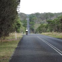
Route photos


Route quality
Waytypes & surfaces along the route
Waytypes
Road
47.7 km
(41 %)
Quiet road
40.7 km
(35 %)
Surfaces
Paved
65.1 km
(56 %)
Unpaved
50 km
(43 %)
Asphalt
64 km
(55 %)
Unpaved (undefined)
34.9 km
(30 %)
Continue with Bikemap
Use, edit, or download this cycling route
You would like to ride Wollomombi circuit alternative or customize it for your own trip? Here is what you can do with this Bikemap route:
Free features
- Save this route as favorite or in collections
- Copy & plan your own version of this route
- Split it into stages to create a multi-day tour
- Sync your route with Garmin or Wahoo
Premium features
Free trial for 3 days, or one-time payment. More about Bikemap Premium.
- Navigate this route on iOS & Android
- Export a GPX / KML file of this route
- Create your custom printout (try it for free)
- Download this route for offline navigation
Discover more Premium features.
Get Bikemap PremiumFrom our community
Other popular routes starting in Armidale
 Armidale Tourist Information Centre to Dangars Gorge return
- Distance
- 47 km
- Ascent
- 355 m
- Descent
- 353 m
- Location
- Armidale, New South Wales, Australia
 Flat White
- Distance
- 19.5 km
- Ascent
- 203 m
- Descent
- 201 m
- Location
- Armidale, New South Wales, Australia
 Armidale to Point Lookout loop
- Distance
- 226.3 km
- Ascent
- 4,225 m
- Descent
- 4,225 m
- Location
- Armidale, New South Wales, Australia
 New England Cycle Trail South
- Distance
- 353.4 km
- Ascent
- 999 m
- Descent
- 1,577 m
- Location
- Armidale, New South Wales, Australia
 Armidale, Toms Gully, Puddledock loop
- Distance
- 71.6 km
- Ascent
- 607 m
- Descent
- 607 m
- Location
- Armidale, New South Wales, Australia
 Armidale, Rockvale Rd Chandler Rd loop
- Distance
- 86.1 km
- Ascent
- 772 m
- Descent
- 773 m
- Location
- Armidale, New South Wales, Australia
 Armidale to Gara river crossing along Herbert Park Rd
- Distance
- 48.3 km
- Ascent
- 516 m
- Descent
- 515 m
- Location
- Armidale, New South Wales, Australia
 Armidale to Uralla via Hawthorne Dr
- Distance
- 72.4 km
- Ascent
- 463 m
- Descent
- 464 m
- Location
- Armidale, New South Wales, Australia
Open it in the app