

De 1593–1735 Route de Saint-Martin, Caumont-sur-Garonne à 1–5 Au Bourg, Allemans-du-Dropt
A cycling route starting in Fourques-sur-Garonne, Nouvelle-Aquitaine, France.
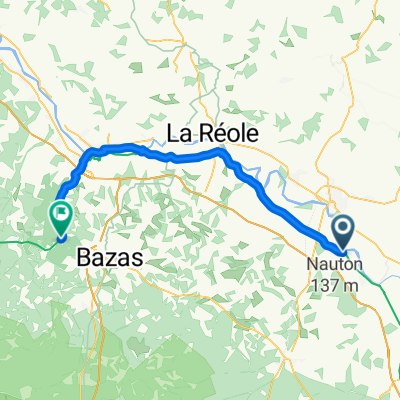
Overview
About this route
- 2 h 5 min
- Duration
- 35 km
- Distance
- 217 m
- Ascent
- 250 m
- Descent
- 16.9 km/h
- Avg. speed
- 122 m
- Max. altitude

Route quality
Waytypes & surfaces along the route
Waytypes
Road
12.9 km
(37 %)
Quiet road
7.4 km
(21 %)
Surfaces
Paved
10.9 km
(31 %)
Asphalt
7.7 km
(22 %)
Paved (undefined)
3.2 km
(9 %)
Undefined
24.1 km
(69 %)
Continue with Bikemap
Use, edit, or download this cycling route
You would like to ride De 1593–1735 Route de Saint-Martin, Caumont-sur-Garonne à 1–5 Au Bourg, Allemans-du-Dropt or customize it for your own trip? Here is what you can do with this Bikemap route:
Free features
- Save this route as favorite or in collections
- Copy & plan your own version of this route
- Sync your route with Garmin or Wahoo
Premium features
Free trial for 3 days, or one-time payment. More about Bikemap Premium.
- Navigate this route on iOS & Android
- Export a GPX / KML file of this route
- Create your custom printout (try it for free)
- Download this route for offline navigation
Discover more Premium features.
Get Bikemap PremiumFrom our community
Other popular routes starting in Fourques-sur-Garonne
 Fourques-sur-Garonne - Noaillan
- Distance
- 56.3 km
- Ascent
- 429 m
- Descent
- 355 m
- Location
- Fourques-sur-Garonne, Nouvelle-Aquitaine, France
 pilat2
- Distance
- 146.5 km
- Ascent
- 243 m
- Descent
- 315 m
- Location
- Fourques-sur-Garonne, Nouvelle-Aquitaine, France
 fourgues sur Garonne tonnains
- Distance
- 19.9 km
- Ascent
- 124 m
- Descent
- 108 m
- Location
- Fourques-sur-Garonne, Nouvelle-Aquitaine, France
 pont des sables - SAUVETERRE
- Distance
- 40.7 km
- Ascent
- 423 m
- Descent
- 378 m
- Location
- Fourques-sur-Garonne, Nouvelle-Aquitaine, France
 De 1593–1735 Route de Saint-Martin, Caumont-sur-Garonne à 1–5 Au Bourg, Allemans-du-Dropt
- Distance
- 35 km
- Ascent
- 217 m
- Descent
- 250 m
- Location
- Fourques-sur-Garonne, Nouvelle-Aquitaine, France
 e14 Le Mas-d'Agenais – Moissac
- Distance
- 98.6 km
- Ascent
- 158 m
- Descent
- 63 m
- Location
- Fourques-sur-Garonne, Nouvelle-Aquitaine, France
 LB Le Mas d'Agenais - Bordeaux
- Distance
- 103.5 km
- Ascent
- 665 m
- Descent
- 686 m
- Location
- Fourques-sur-Garonne, Nouvelle-Aquitaine, France
 4 Place du Marché, Le Mas-d'Agenais do 41–43 Quai de Dunkerque, Agen
- Distance
- 50.6 km
- Ascent
- 331 m
- Descent
- 324 m
- Location
- Fourques-sur-Garonne, Nouvelle-Aquitaine, France
Open it in the app