- 34.2 km
- 489 m
- 272 m
- Aix-les-Bains, Auvergne-Rh么ne-Alpes, France
Aix-les-Bains Mont Revard
A cycling route starting in Aix-les-Bains, Auvergne-Rh么ne-Alpes, France.
Overview
About this route
I haven't ridden this route on my road bike yet. When I was 21 and spent a summer holiday at Revard, I used to laugh at all the crazies, mostly older gentlemen, who senselessly rode their bikes up and down the mountain.....
- -:--
- Duration
- 20.4 km
- Distance
- 1,320 m
- Ascent
- 133 m
- Descent
- ---
- Avg. speed
- 1,461 m
- Max. altitude
created this 17 years ago
Route quality
Waytypes & surfaces along the route
Waytypes
Quiet road
1.4 km
(7 %)
Road
0.8 km
(4 %)
Surfaces
Paved
17.4 km
(85 %)
Unpaved
0.6 km
(3 %)
Asphalt
17.4 km
(85 %)
Gravel
0.6 km
(3 %)
Undefined
2.5 km
(12 %)
Continue with Bikemap
Use, edit, or download this cycling route
You would like to ride Aix-les-Bains Mont Revard or customize it for your own trip? Here is what you can do with this Bikemap route:
Free features
- Save this route as favorite or in collections
- Copy & plan your own version of this route
- Sync your route with Garmin or Wahoo
Premium features
Free trial for 3 days, or one-time payment. More about Bikemap Premium.
- Navigate this route on iOS & Android
- Export a GPX / KML file of this route
- Create your custom printout (try it for free)
- Download this route for offline navigation
Discover more Premium features.
Get Bikemap PremiumFrom our community
Other popular routes starting in Aix-les-Bains
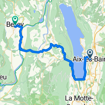
- Aix-Les-Bains to Annecy
- Aix-les-Bains - Belley - 2-Aix-les-Bains - Belley
- 41.8 km
- 579 m
- 545 m
- Aix-les-Bains, Auvergne-Rh么ne-Alpes, France
- De Rue du Maroc 85, Aix-les-Bains 脿 Chemin la Tessonni猫re d'en Bas 117, La Motte-Servolex
- 14.3 km
- 154 m
- 120 m
- Aix-les-Bains, Auvergne-Rh么ne-Alpes, France
- Pyenees to the Alps day 6 a
- 85.6 km
- 690 m
- 564 m
- Aix-les-Bains, Auvergne-Rh么ne-Alpes, France
- ballades des 3 lacs avec D+
- 230.9 km
- 3,430 m
- 3,193 m
- Aix-les-Bains, Auvergne-Rh么ne-Alpes, France
- 150 - 17 - Aix-les-Bains - Flaine
- 207.5 km
- 5,634 m
- 4,279 m
- Aix-les-Bains, Auvergne-Rh么ne-Alpes, France
- 3 - Aux-Les-Bains to Talloires - Backup 1
- 107.2 km
- 867 m
- 678 m
- Aix-les-Bains, Auvergne-Rh么ne-Alpes, France
- Aix le Bains to Annecy
- 39.6 km
- 683 m
- 505 m
- Aix-les-Bains, Auvergne-Rh么ne-Alpes, France
Open it in the app


