

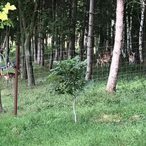
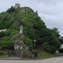
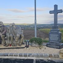
Lednice
A cycling route starting in Herrnbaumgarten, Lower Austria, Austria.
Overview
About this route
Route von „Gemeinde Herrnbaumgarten, Mistelbach, Niederösterreich, 2171, Österreich, 2171 Gemeinde Herrnbaumgarten“ nach „691 44 Lednice, 691 44 Lednice“ via „691 21 Sedlec, 691 21 Sedlec“, „691 44 Lednice, 691 44 Lednice“, „Zámek 1, 691 44 Lednice“
- -:--
- Duration
- 47.2 km
- Distance
- 478 m
- Ascent
- 477 m
- Descent
- ---
- Avg. speed
- 305 m
- Max. altitude

Route quality
Waytypes & surfaces along the route
Waytypes
Track
34.5 km
(73 %)
Quiet road
4.2 km
(9 %)
Surfaces
Paved
16 km
(34 %)
Unpaved
22.7 km
(48 %)
Asphalt
15.6 km
(33 %)
Gravel
12.7 km
(27 %)
Continue with Bikemap
Use, edit, or download this cycling route
You would like to ride Lednice or customize it for your own trip? Here is what you can do with this Bikemap route:
Free features
- Save this route as favorite or in collections
- Copy & plan your own version of this route
- Sync your route with Garmin or Wahoo
Premium features
Free trial for 3 days, or one-time payment. More about Bikemap Premium.
- Navigate this route on iOS & Android
- Export a GPX / KML file of this route
- Create your custom printout (try it for free)
- Download this route for offline navigation
Discover more Premium features.
Get Bikemap PremiumFrom our community
Other popular routes starting in Herrnbaumgarten
 Herrnbaumgarten-Tennauwaldrunde
- Distance
- 14.9 km
- Ascent
- 202 m
- Descent
- 208 m
- Location
- Herrnbaumgarten, Lower Austria, Austria
 Liechtensteinrunde
- Distance
- 56.9 km
- Ascent
- 252 m
- Descent
- 252 m
- Location
- Herrnbaumgarten, Lower Austria, Austria
 Hauptstraße 65, Herrnbaumgarten - Hauptstraße 65, Herrnbaumgarten
- Distance
- 71.8 km
- Ascent
- 677 m
- Descent
- 729 m
- Location
- Herrnbaumgarten, Lower Austria, Austria
 Weinvierteltour 1090hm, ~ 90km
- Distance
- 89.2 km
- Ascent
- 780 m
- Descent
- 777 m
- Location
- Herrnbaumgarten, Lower Austria, Austria
 Falkenstein
- Distance
- 41.7 km
- Ascent
- 728 m
- Descent
- 728 m
- Location
- Herrnbaumgarten, Lower Austria, Austria
 Herrnbaumgarten -Mikulov
- Distance
- 69.4 km
- Ascent
- 684 m
- Descent
- 681 m
- Location
- Herrnbaumgarten, Lower Austria, Austria
 Lednice
- Distance
- 47.2 km
- Ascent
- 478 m
- Descent
- 477 m
- Location
- Herrnbaumgarten, Lower Austria, Austria
 Dyje Thaya Herrnbaum-Südmährenkreuz-Mikulov
- Distance
- 26.3 km
- Ascent
- 269 m
- Descent
- 312 m
- Location
- Herrnbaumgarten, Lower Austria, Austria
Open it in the app