

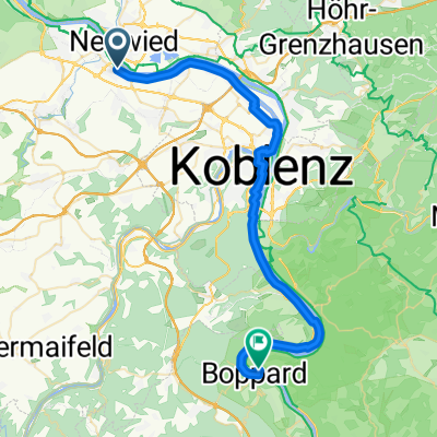
Pegelturm_Andern_Fähre Breisig_Arenfels-Runde 38km
A cycling route starting in Weißenthurm, Rhineland-Palatinate, Germany.
Overview
About this route
Tour:
from Neuwied Pegelturm, Rhine bridge, Weißenthurm, Vulkanparkweg, Andernach, Sculpture Park at the Einstein Hotel, Alter Kranen, Burg Namedy, Bad Breisig-Rheinbrohl ferry, Bad Hönningen, Castle Arenfels with Restaurant Schlosseria (open from Wed at 12pm), Limesturm Rheinbrohl, Hammerstein, Leutesdorf, Neuwied
- -:--
- Duration
- 38 km
- Distance
- 163 m
- Ascent
- 157 m
- Descent
- ---
- Avg. speed
- 91 m
- Max. altitude
Route quality
Waytypes & surfaces along the route
Waytypes
Quiet road
16.4 km
(43 %)
Path
7.2 km
(19 %)
Surfaces
Paved
27.8 km
(73 %)
Asphalt
26.2 km
(69 %)
Paved (undefined)
0.8 km
(2 %)
Continue with Bikemap
Use, edit, or download this cycling route
You would like to ride Pegelturm_Andern_Fähre Breisig_Arenfels-Runde 38km or customize it for your own trip? Here is what you can do with this Bikemap route:
Free features
- Save this route as favorite or in collections
- Copy & plan your own version of this route
- Sync your route with Garmin or Wahoo
Premium features
Free trial for 3 days, or one-time payment. More about Bikemap Premium.
- Navigate this route on iOS & Android
- Export a GPX / KML file of this route
- Create your custom printout (try it for free)
- Download this route for offline navigation
Discover more Premium features.
Get Bikemap PremiumFrom our community
Other popular routes starting in Weißenthurm
 Pegelturm_Andern_Fähre Breisig_Arenfels-Runde 38km
- Distance
- 38 km
- Ascent
- 163 m
- Descent
- 157 m
- Location
- Weißenthurm, Rhineland-Palatinate, Germany
 Nette-Obst-Radrunde ü. Plaidt45 km - Nette-Obst-Radrunde ü. Plaidt45 km
- Distance
- 44.6 km
- Ascent
- 228 m
- Descent
- 228 m
- Location
- Weißenthurm, Rhineland-Palatinate, Germany
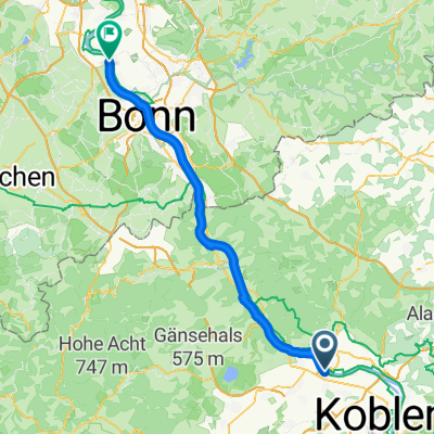
 Weißenthurm - Boppard
- Distance
- 39.6 km
- Ascent
- 211 m
- Descent
- 201 m
- Location
- Weißenthurm, Rhineland-Palatinate, Germany
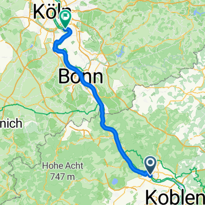
 Weißenthurm - Niederkassel
- Distance
- 62.1 km
- Ascent
- 384 m
- Descent
- 399 m
- Location
- Weißenthurm, Rhineland-Palatinate, Germany
 Weißenthurm - Bacharach
- Distance
- 68.4 km
- Ascent
- 627 m
- Descent
- 585 m
- Location
- Weißenthurm, Rhineland-Palatinate, Germany
 Efteling - Tag 18
- Distance
- 76.5 km
- Ascent
- 129 m
- Descent
- 138 m
- Location
- Weißenthurm, Rhineland-Palatinate, Germany
 Weißenth-Laacher See-Waldfrieden-Hohe Buche-Waldabfahrt Eselsweg nach Namedy-Andern 44 km
- Distance
- 43.1 km
- Ascent
- 528 m
- Descent
- 530 m
- Location
- Weißenthurm, Rhineland-Palatinate, Germany
 Weißenthurm_Laacher See_Runde
- Distance
- 45.4 km
- Ascent
- 340 m
- Descent
- 346 m
- Location
- Weißenthurm, Rhineland-Palatinate, Germany
Open it in the app