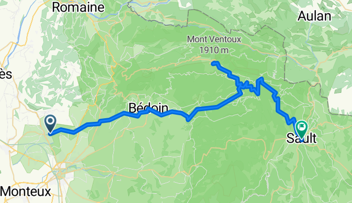
Aubignan Mont Ventoux Sault

A cycling route starting in Aubignan, Provence-Alpes-C么te d'Azur Region, France.
OverviewAbout this route

Klassische Route 眉ber Bedoin zum Mont Ventoux. Tip: Bei warmer Witterung ordentlich Autan (auch auf die Kleidung)auftragen, sonst hat man im Wald bis zum Chalet Reynard einen Fliegen und M眉ckenschwarm um sich! F眉r die Nordroute 眉ber Malauc猫ne ist dies nicht n枚tig (mais ca, ca n'est pas le Mont Ventoux!). Die聽Abfahrt 眉ber Bedoin ist nicht mehr so gef盲hrlich wie fr眉her, da der Asfalt neu ist (2007).

-:--
Duration
61.4 km
Distance
2,284 m
Ascent
1,517 m
Descent
---
Avg. speed
1,891 m
Max. altitude
racebiker-gecreated this 17 years ago
Route qualityWaytypes & surfaces along the route
Waytypes
  • Road

    8.6 km14 %
  • Quiet road

    3.7 km6 %
  • Track

    3.1 km5 %
Surfaces

Paved

54.6 km(89 %)
  • Asphalt

    53.4 km87 %
  • Paved (undefined)

    0.6 km1 %
  • Concrete

    0.6 km1 %
Continue with BikemapUse, edit, or download this cycling route
You would like to ride Aubignan Mont Ventoux Sault or customize it for your own trip? Here is what you can do with this Bikemap route:
Free features
Premium features

Free trial for 3 days, or one-time payment. More about Bikemap Premium.

  • Navigate this route on iOS & Android
  • Export a GPX / KML file of this route
  • Create your custom printout (try it for free)
  • Download this route for offline navigation

Discover more Premium features.

Get Bikemap Premium
From our communityOther popular routes starting in Aubignan

Open it in the app