

Percorsi Parco dell'Oglio
A cycling route starting in San Giovanni in Croce, Lombardy, Italy.
Overview
About this route
Nice tirp via either the lands of the park'Oglio.
The path is paved and (via roads) that dirt road (along the banks of the River Oglio).
<span style="border-collapse: separate; color: #000000; font-style: normal; font-variant: normal; font-weight: normal; letter-spacing: normal; line-height: normal; orphans: 2; text-indent: 0px; text-transform: none; white-space: normal; widows: 2; word-spacing: 0px; font-family: 'Times New Roman'; font-size: medium;"><span class="Apple-style-span" style="font-family: arial,sans-serif; font-size: 24px;"></span></span>
- -:--
- Duration
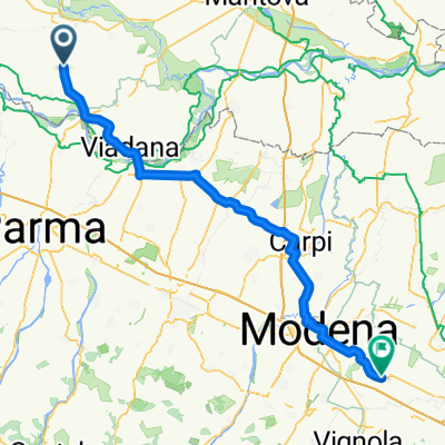
- 39.7 km
- Distance
- 47 m
- Ascent
- 44 m
- Descent
- ---
- Avg. speed
- ---
- Max. altitude

Continue with Bikemap
Use, edit, or download this cycling route
You would like to ride Percorsi Parco dell'Oglio or customize it for your own trip? Here is what you can do with this Bikemap route:
Free features
- Save this route as favorite or in collections
- Copy & plan your own version of this route
- Sync your route with Garmin or Wahoo
Premium features
Free trial for 3 days, or one-time payment. More about Bikemap Premium.
- Navigate this route on iOS & Android
- Export a GPX / KML file of this route
- Create your custom printout (try it for free)
- Download this route for offline navigation
Discover more Premium features.
Get Bikemap PremiumFrom our community
Other popular routes starting in San Giovanni in Croce
 Percorsi Parco dell'Oglio
- Distance
- 39.7 km
- Ascent
- 47 m
- Descent
- 44 m
- Location
- San Giovanni in Croce, Lombardy, Italy
 percorso 25 km
- Distance
- 24.6 km
- Ascent
- 30 m
- Descent
- 28 m
- Location
- San Giovanni in Croce, Lombardy, Italy
 San Giovanni in Croce - Castelfranco Emilia
- Distance
- 93.1 km
- Ascent
- 17 m
- Descent
- 6 m
- Location
- San Giovanni in Croce, Lombardy, Italy
 25 km
25 km- Distance
- 24.6 km
- Ascent
- 30 m
- Descent
- 28 m
- Location
- San Giovanni in Croce, Lombardy, Italy
Open it in the app