
feldberg und brot
- 72.5 km
- 955 m
- 955 m
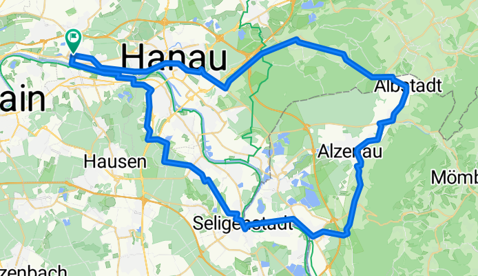
- Maintal, Hesse, Germany
A cycling route starting in Maintal, Hesse, Germany.
Overview
Cozy route to Seligenstadt, then take the ferry across. It’s a steady climb up to Wasserlos. Then downhill to Alzenau, Michelbach. After Albstadt, it climbs again. But the descent is wonderful. The rest is solid cyclist fare.
created this 18 years ago
Route quality
Quiet road
14.9 km
(24 %)
Path
14.9 km
(24 %)
Paved
42.2 km
(68 %)
Unpaved
9.3 km
(15 %)
Asphalt
41 km
(66 %)
Gravel
5.6 km
(9 %)
Continue with Bikemap
You would like to ride PW Maintal Seligenstadt Albstadt Hanau Maintal or customize it for your own trip? Here is what you can do with this Bikemap route:
Free trial for 3 days, or one-time payment. More about Bikemap Premium.
Discover more Premium features.
Get Bikemap PremiumFrom our community
Open it in the app