

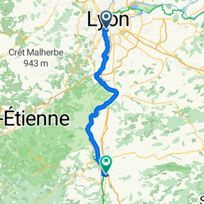
Lyon-Cassis
A cycling route starting in La Mulatière, Auvergne-Rhône-Alpes, France.
Overview
About this route
Day One : Lyon-Valence
Day Two : Valence-Bagnols sur Cèze
Day Three : Bagnols-Mallemort
Day Four : Mallemort-Cassis
- -:--
- Duration
- 426.4 km
- Distance
- 1,326 m
- Ascent
- 1,182 m
- Descent
- ---
- Avg. speed
- ---
- Max. altitude

Route highlights
Points of interest along the route
Point of interest after 136.4 km
Séjour chez Yann
Point of interest after 236.6 km
Séjour chez Isabelle
Point of interest after 317.3 km
Camping !
Point of interest after 360.8 km
Mangé !
Point of interest after 426.4 km
Arrivée
Continue with Bikemap
Use, edit, or download this cycling route
You would like to ride Lyon-Cassis or customize it for your own trip? Here is what you can do with this Bikemap route:
Free features
- Save this route as favorite or in collections
- Copy & plan your own version of this route
- Split it into stages to create a multi-day tour
- Sync your route with Garmin or Wahoo
Premium features
Free trial for 3 days, or one-time payment. More about Bikemap Premium.
- Navigate this route on iOS & Android
- Export a GPX / KML file of this route
- Create your custom printout (try it for free)
- Download this route for offline navigation
Discover more Premium features.
Get Bikemap PremiumFrom our community
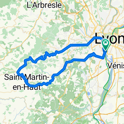
Other popular routes starting in La Mulatière
 Lyon - Saint Rambert-d'Albon
- Distance
- 73 km
- Ascent
- 382 m
- Descent
- 394 m
- Location
- La Mulatière, Auvergne-Rhône-Alpes, France
 Route stable en Lyon
- Distance
- 30.6 km
- Ascent
- 139 m
- Descent
- 140 m
- Location
- La Mulatière, Auvergne-Rhône-Alpes, France
 De Quai Rambaud 52, Lyon à Musée des Confluences, Lyon
- Distance
- 73.8 km
- Ascent
- 1,427 m
- Descent
- 1,423 m
- Location
- La Mulatière, Auvergne-Rhône-Alpes, France
 Lyon-Cassis
- Distance
- 426.4 km
- Ascent
- 1,326 m
- Descent
- 1,182 m
- Location
- La Mulatière, Auvergne-Rhône-Alpes, France
 F 610: Lyon - Vienne - Lyon
- Distance
- 70.8 km
- Ascent
- 415 m
- Descent
- 413 m
- Location
- La Mulatière, Auvergne-Rhône-Alpes, France
 LYON BALLADE
- Distance
- 25.1 km
- Ascent
- 47 m
- Descent
- 48 m
- Location
- La Mulatière, Auvergne-Rhône-Alpes, France
 Les 7 Cols des Monts du Lyonnais
- Distance
- 205.5 km
- Ascent
- 2,804 m
- Descent
- 2,711 m
- Location
- La Mulatière, Auvergne-Rhône-Alpes, France
 Route stable en Lyon
- Distance
- 10.3 km
- Ascent
- 16 m
- Descent
- 16 m
- Location
- La Mulatière, Auvergne-Rhône-Alpes, France
Open it in the app