

Tour de France (Aussie edition)
A cycling route starting in Queanbeyan, New South Wales, Australia.
Overview
About this route
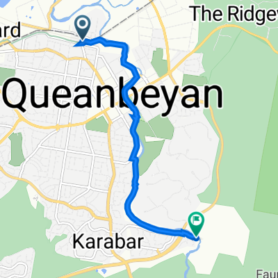
The stage will begin at the border of Queenbeyan which will then head NE to Braidwood to then be travelling SE towards the shore. Once they arrive at Batemans bay they will then travel North up the coast to then finish in Nowra. The course is 223.8 km long making it very hard for the riders. The KOM stage will finish at Currowan creek making those climbers sprint away from the peleton. This race will be a great tourist event as many people will be cheering on the side of the roads.
- -:--
- Duration
- 223.8 km
- Distance
- 873 m
- Ascent
- 1,551 m
- Descent
- ---
- Avg. speed
- 805 m
- Max. altitude
Continue with Bikemap
Use, edit, or download this cycling route
You would like to ride Tour de France (Aussie edition) or customize it for your own trip? Here is what you can do with this Bikemap route:
Free features
- Save this route as favorite or in collections
- Copy & plan your own version of this route
- Split it into stages to create a multi-day tour
- Sync your route with Garmin or Wahoo
Premium features
Free trial for 3 days, or one-time payment. More about Bikemap Premium.
- Navigate this route on iOS & Android
- Export a GPX / KML file of this route
- Create your custom printout (try it for free)
- Download this route for offline navigation
Discover more Premium features.
Get Bikemap PremiumFrom our community
Other popular routes starting in Queanbeyan
 Tour de France (Aussie edition)
- Distance
- 223.8 km
- Ascent
- 873 m
- Descent
- 1,551 m
- Location
- Queanbeyan, New South Wales, Australia
 Queanbeyan River (Railway Station to Valley Creek)
- Distance
- 5.7 km
- Ascent
- 51 m
- Descent
- 55 m
- Location
- Queanbeyan, New South Wales, Australia
 Queanbeyan circuit
- Distance
- 21.7 km
- Ascent
- 299 m
- Descent
- 301 m
- Location
- Queanbeyan, New South Wales, Australia
 Century Trail Cycling Route
- Distance
- 146.5 km
- Ascent
- 856 m
- Descent
- 872 m
- Location
- Queanbeyan, New South Wales, Australia
 Googong circuit
- Distance
- 16.9 km
- Ascent
- 130 m
- Descent
- 127 m
- Location
- Queanbeyan, New South Wales, Australia
 Kowen 13km Loop + Mont 2016 15 km Loop
- Distance
- 28.8 km
- Ascent
- 306 m
- Descent
- 306 m
- Location
- Queanbeyan, New South Wales, Australia
 Queanbeyan circumference loop
- Distance
- 22.7 km
- Ascent
- 294 m
- Descent
- 296 m
- Location
- Queanbeyan, New South Wales, Australia
 Queanbeyan to Googong
- Distance
- 22.4 km
- Ascent
- 377 m
- Descent
- 194 m
- Location
- Queanbeyan, New South Wales, Australia
Open it in the app