

Le pré de la Dame (Mont Lozère)
A cycling route starting in Saint-Ambroix, Occitanie, France.
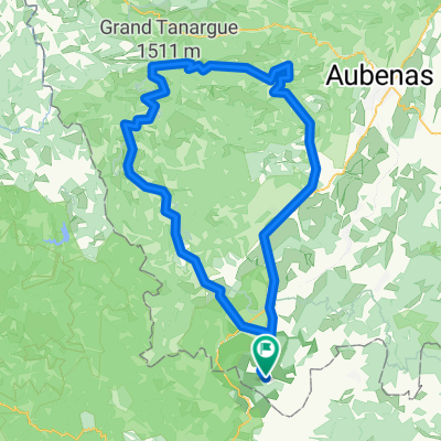
Overview
About this route
Superb route!
In one direction or the other (depending on the wind)...
The climb to Mont Lozère via Génolhac is truly very beautiful with lovely views of the Piedmont and the plateaus of Lozère.
- -:--
- Duration
- 114.2 km
- Distance
- 1,897 m
- Ascent
- 1,897 m
- Descent
- ---
- Avg. speed
- ---
- Max. altitude

Continue with Bikemap
Use, edit, or download this cycling route
You would like to ride Le pré de la Dame (Mont Lozère) or customize it for your own trip? Here is what you can do with this Bikemap route:
Free features
- Save this route as favorite or in collections
- Copy & plan your own version of this route
- Split it into stages to create a multi-day tour
- Sync your route with Garmin or Wahoo
Premium features
Free trial for 3 days, or one-time payment. More about Bikemap Premium.
- Navigate this route on iOS & Android
- Export a GPX / KML file of this route
- Create your custom printout (try it for free)
- Download this route for offline navigation
Discover more Premium features.
Get Bikemap PremiumFrom our community
Other popular routes starting in Saint-Ambroix
 road road road
- Distance
- 18.3 km
- Ascent
- 310 m
- Descent
- 312 m
- Location
- Saint-Ambroix, Occitanie, France
 Le Chap des Bosc
- Distance
- 123.3 km
- Ascent
- 1,515 m
- Descent
- 1,513 m
- Location
- Saint-Ambroix, Occitanie, France
 Le pré de la Dame (Mont Lozère)
- Distance
- 114.2 km
- Ascent
- 1,897 m
- Descent
- 1,897 m
- Location
- Saint-Ambroix, Occitanie, France
 Trarabias-Col de Banette
- Distance
- 101.7 km
- Ascent
- 1,161 m
- Descent
- 1,161 m
- Location
- Saint-Ambroix, Occitanie, France
 Gorges de l' Ardeche
- Distance
- 104.3 km
- Ascent
- 705 m
- Descent
- 703 m
- Location
- Saint-Ambroix, Occitanie, France
 road up, trail down
- Distance
- 12.5 km
- Ascent
- 361 m
- Descent
- 367 m
- Location
- Saint-Ambroix, Occitanie, France
 Croix de Beauzon-col de Meyrand
- Distance
- 139.3 km
- Ascent
- 2,100 m
- Descent
- 2,100 m
- Location
- Saint-Ambroix, Occitanie, France
 route to saint ambroix
- Distance
- 19.6 km
- Ascent
- 201 m
- Descent
- 211 m
- Location
- Saint-Ambroix, Occitanie, France
Open it in the app