Vetterrunde 01-0428
A cycling route starting in Ravensburg, Baden-Wurttemberg, Germany.
Overview
About this route
- -:--
- Duration
- 47.1 km
- Distance
- 406 m
- Ascent
- 332 m
- Descent
- ---
- Avg. speed
- ---
- Max. altitude
Route quality
Waytypes & surfaces along the route
Waytypes
Road
15.2 km
(32 %)
Quiet road
14.1 km
(30 %)
Surfaces
Paved
44.2 km
(94 %)
Unpaved
0.3 km
(<1 %)
Asphalt
44.2 km
(94 %)
Gravel
0.2 km
(<1 %)
Continue with Bikemap
Use, edit, or download this cycling route
You would like to ride Vetterrunde 01-0428 or customize it for your own trip? Here is what you can do with this Bikemap route:
Free features
- Save this route as favorite or in collections
- Copy & plan your own version of this route
- Sync your route with Garmin or Wahoo
Premium features
Free trial for 3 days, or one-time payment. More about Bikemap Premium.
- Navigate this route on iOS & Android
- Export a GPX / KML file of this route
- Create your custom printout (try it for free)
- Download this route for offline navigation
Discover more Premium features.
Get Bikemap PremiumFrom our community
Other popular routes starting in Ravensburg
- Von Ravensburg nach Meersburg
- Distance
- 29.6 km
- Ascent
- 264 m
- Descent
- 288 m
- Location
- Ravensburg, Baden-Wurttemberg, Germany
- 20110507_RV_Deggenhausen_Illmensee_RV
- Distance
- 68.8 km
- Ascent
- 437 m
- Descent
- 436 m
- Location
- Ravensburg, Baden-Wurttemberg, Germany
- Von Ravensburg nach Friedrichshafen - Sommerweg
- Distance
- 20.5 km
- Ascent
- 68 m
- Descent
- 94 m
- Location
- Ravensburg, Baden-Wurttemberg, Germany
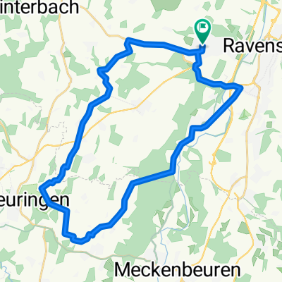
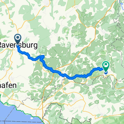
- RV_Kressbronn_Selmnau_Tettnang_RV
- Distance
- 54.7 km
- Ascent
- 366 m
- Descent
- 366 m
- Location
- Ravensburg, Baden-Wurttemberg, Germany
- Ravensburg - Obereisenbach - Ettenkirchen - Runde
- Distance
- 40.6 km
- Ascent
- 470 m
- Descent
- 476 m
- Location
- Ravensburg, Baden-Wurttemberg, Germany
- Ravensburg - Gruenkraut - Bodnegg - Runde
- Distance
- 30.9 km
- Ascent
- 381 m
- Descent
- 387 m
- Location
- Ravensburg, Baden-Wurttemberg, Germany
- RV_Ailinger Kapelle_Eriskirch_RV
- Distance
- 58.5 km
- Ascent
- 287 m
- Descent
- 286 m
- Location
- Ravensburg, Baden-Wurttemberg, Germany
- Von Ravensburg zum Pfrunger Ried
- Distance
- 75.9 km
- Ascent
- 494 m
- Descent
- 494 m
- Location
- Ravensburg, Baden-Wurttemberg, Germany
Open it in the app