

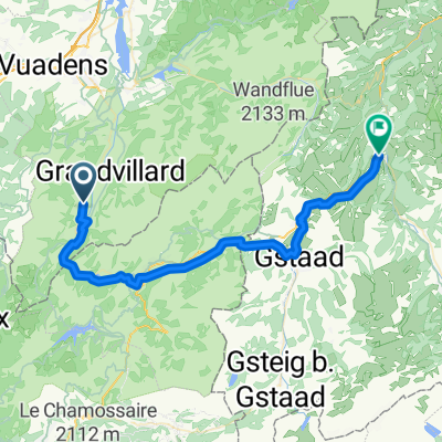
Les Mosses - Billens
A cycling route starting in Chateau-d'Oex, Canton of Vaud, Switzerland.
Overview
About this route
The Intyamond valley via the small road is superb. Otherwise, there is still too much traffic between Bulle and Romont.
- -:--
- Duration
- 61.7 km
- Distance
- 348 m
- Ascent
- 1,084 m
- Descent
- ---
- Avg. speed
- ---
- Max. altitude
Route quality
Waytypes & surfaces along the route
Waytypes
Quiet road
16 km
(26 %)
Road
3.1 km
(5 %)
Surfaces
Paved
40.1 km
(65 %)
Asphalt
40.1 km
(65 %)
Undefined
21.6 km
(35 %)
Continue with Bikemap
Use, edit, or download this cycling route
You would like to ride Les Mosses - Billens or customize it for your own trip? Here is what you can do with this Bikemap route:
Free features
- Save this route as favorite or in collections
- Copy & plan your own version of this route
- Sync your route with Garmin or Wahoo
Premium features
Free trial for 3 days, or one-time payment. More about Bikemap Premium.
- Navigate this route on iOS & Android
- Export a GPX / KML file of this route
- Create your custom printout (try it for free)
- Download this route for offline navigation
Discover more Premium features.
Get Bikemap PremiumFrom our community
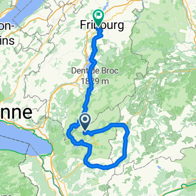
Other popular routes starting in Chateau-d'Oex
 07 - Hongrin-Villeneuve
- Distance
- 51.1 km
- Ascent
- 341 m
- Descent
- 1,274 m
- Location
- Chateau-d'Oex, Canton of Vaud, Switzerland
 Cross-country 1997 Château-d'Oex
- Distance
- 7.9 km
- Ascent
- 283 m
- Descent
- 284 m
- Location
- Chateau-d'Oex, Canton of Vaud, Switzerland
 Route de l'Intyamon, Albeuve nach Bahnhofstrasse, Zweisimmen
- Distance
- 43.9 km
- Ascent
- 1,259 m
- Descent
- 1,082 m
- Location
- Chateau-d'Oex, Canton of Vaud, Switzerland
 Cyclo Rando jour 2
- Distance
- 71 km
- Ascent
- 2,305 m
- Descent
- 2,489 m
- Location
- Chateau-d'Oex, Canton of Vaud, Switzerland
 La Lécherette - Genf (FR-MA5)
- Distance
- 112 km
- Ascent
- 308 m
- Descent
- 1,303 m
- Location
- Chateau-d'Oex, Canton of Vaud, Switzerland
 Alpine Bike No. 1 Day 15 Gstaad - Col des Mosses
- Distance
- 29.2 km
- Ascent
- 249 m
- Descent
- 646 m
- Location
- Chateau-d'Oex, Canton of Vaud, Switzerland
 2013-08-22 Les Moulins - Aigen
- Distance
- 41.7 km
- Ascent
- 984 m
- Descent
- 1,454 m
- Location
- Chateau-d'Oex, Canton of Vaud, Switzerland
 Rossinière-Mosses-Diablerets-Hongrin-Arconciel-FR
- Distance
- 120.8 km
- Ascent
- 2,854 m
- Descent
- 3,100 m
- Location
- Chateau-d'Oex, Canton of Vaud, Switzerland
Open it in the app