
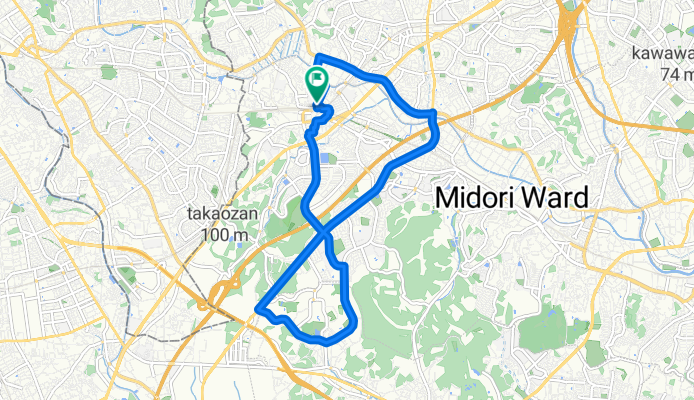
route 1
A cycling route starting in Machida, Tokyo, Japan.
Overview
About this route
- 43 min
- Duration
- 12.6 km
- Distance
- 131 m
- Ascent
- 134 m
- Descent
- 17.5 km/h
- Avg. speed
- 87 m
- Max. altitude
Route quality
Waytypes & surfaces along the route
Waytypes
Road
4.7 km
(37 %)
Quiet road
3.3 km
(26 %)
Surfaces
Paved
3.3 km
(26 %)
Asphalt
1.9 km
(15 %)
Paved (undefined)
1.4 km
(11 %)
Undefined
9.3 km
(74 %)
Continue with Bikemap
Use, edit, or download this cycling route
You would like to ride route 1 or customize it for your own trip? Here is what you can do with this Bikemap route:
Free features
- Save this route as favorite or in collections
- Copy & plan your own version of this route
- Sync your route with Garmin or Wahoo
Premium features
Free trial for 3 days, or one-time payment. More about Bikemap Premium.
- Navigate this route on iOS & Android
- Export a GPX / KML file of this route
- Create your custom printout (try it for free)
- Download this route for offline navigation
Discover more Premium features.
Get Bikemap PremiumFrom our community
Other popular routes starting in Machida
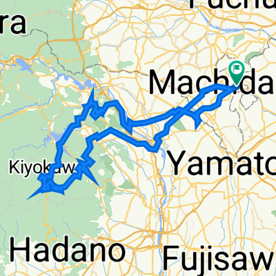
 Giro semplice in Minami-Ku, Sagamihara-Shi
- Distance
- 72.1 km
- Ascent
- 252 m
- Descent
- 278 m
- Location
- Machida, Tokyo, Japan
 初ライド
初ライド- Distance
- 36.7 km
- Ascent
- 108 m
- Descent
- 106 m
- Location
- Machida, Tokyo, Japan
 家から橋本コーナンまで
- Distance
- 8.8 km
- Ascent
- 95 m
- Descent
- 65 m
- Location
- Machida, Tokyo, Japan
 route 1
- Distance
- 12.6 km
- Ascent
- 131 m
- Descent
- 134 m
- Location
- Machida, Tokyo, Japan
 enoshima Beach route
- Distance
- 29.2 km
- Ascent
- 281 m
- Descent
- 333 m
- Location
- Machida, Tokyo, Japan
 Monomi-Dirt
- Distance
- 103.4 km
- Ascent
- 3,002 m
- Descent
- 3,002 m
- Location
- Machida, Tokyo, Japan
 Route from 2-chōme 41, Machida
- Distance
- 14.8 km
- Ascent
- 175 m
- Descent
- 207 m
- Location
- Machida, Tokyo, Japan
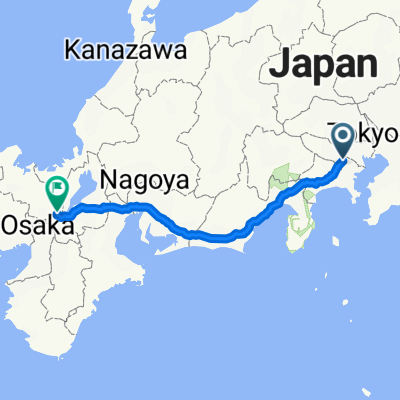 2丁目 25, 川崎市 to 442−1, 京都市
- Distance
- 466.3 km
- Ascent
- 4,482 m
- Descent
- 4,469 m
- Location
- Machida, Tokyo, Japan
Open it in the app