
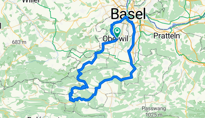
Blauen-Liesberg-Basel
A cycling route starting in Oberwil, Basel-Landschaft, Switzerland.
Overview
About this route
- -:--
- Duration
- 65.8 km
- Distance
- 800 m
- Ascent
- 800 m
- Descent
- ---
- Avg. speed
- ---
- Max. altitude
Route quality
Waytypes & surfaces along the route
Waytypes
Quiet road
12.5 km
(19 %)
Road
7.2 km
(11 %)
Surfaces
Paved
31.6 km
(48 %)
Unpaved
1.3 km
(2 %)
Asphalt
31.6 km
(48 %)
Unpaved (undefined)
0.7 km
(1 %)
Continue with Bikemap
Use, edit, or download this cycling route
You would like to ride Blauen-Liesberg-Basel or customize it for your own trip? Here is what you can do with this Bikemap route:
Free features
- Save this route as favorite or in collections
- Copy & plan your own version of this route
- Sync your route with Garmin or Wahoo
Premium features
Free trial for 3 days, or one-time payment. More about Bikemap Premium.
- Navigate this route on iOS & Android
- Export a GPX / KML file of this route
- Create your custom printout (try it for free)
- Download this route for offline navigation
Discover more Premium features.
Get Bikemap PremiumFrom our community
Other popular routes starting in Oberwil
 kleine Fricktaler-Berge Runde
- Distance
- 65.4 km
- Ascent
- 812 m
- Descent
- 817 m
- Location
- Oberwil, Basel-Landschaft, Switzerland
 im Jura bis Passwang
- Distance
- 74.5 km
- Ascent
- 1,534 m
- Descent
- 1,513 m
- Location
- Oberwil, Basel-Landschaft, Switzerland
 Blauenberg bis Blochmont
- Distance
- 63.7 km
- Ascent
- 1,197 m
- Descent
- 1,192 m
- Location
- Oberwil, Basel-Landschaft, Switzerland
 Blauen-Liesberg-Basel
- Distance
- 65.8 km
- Ascent
- 800 m
- Descent
- 800 m
- Location
- Oberwil, Basel-Landschaft, Switzerland
 Kandertal
- Distance
- 66.7 km
- Ascent
- 668 m
- Descent
- 673 m
- Location
- Oberwil, Basel-Landschaft, Switzerland
 Blauen - Eggflue
- Distance
- 27.3 km
- Ascent
- 673 m
- Descent
- 673 m
- Location
- Oberwil, Basel-Landschaft, Switzerland
 Elsass-Kandertal
- Distance
- 108 km
- Ascent
- 658 m
- Descent
- 613 m
- Location
- Oberwil, Basel-Landschaft, Switzerland
 Buuseregg-Bürenflue
- Distance
- 77.1 km
- Ascent
- 976 m
- Descent
- 995 m
- Location
- Oberwil, Basel-Landschaft, Switzerland
Open it in the app